Madagascar is an island nation located off the southeast coast of Africa that is well known for its varied species of wildlife and beautiful landscapes. The city of Mahajanga boasts a tropical climate, pristine beaches, and picturesque scenery. Accessible by taxi-brousse (a van; the Malagasy form of medium-to-long distance transit) from the capital city of Antananarivo (about 10 hours with the taxi-brousse company Cotisse), it’s one of the more accessible tourist destinations in Madagascar.
What to do in Madagascar
Petite Plage is a serene beach area just north of the city (via taxi-bus #6). For 3,000ar (1 USD) you can rent an umbrella and mats for the day, and enjoy the year-round warmth of the Mozambique Channel. There are local foods available there, including lunches served to your spot on the beach (3 to 7 USD per meal).
About 3 miles up the coast is another beach area called Grand Pavois, which is even quieter than Petite Plage. This area has a few more restaurants and bars, as well as nicer hotels nearby. This beach also offers cabanas with beach beds, chairs, or picnic tables. Grand Pavois can be reached by taking a private taxi from Mahajanga (60,000ar or 19 USD round trip) or taxi-bus #15 and walking a further 1.5 miles (500ar or 16 cents). Some great sightseeing can be done just a 10 minute walk beyond Grand Pavois at Cirque Rouge. This group of small mountains ranges in color from lilac to all shades of red.
While Malagasy meals are famous for their rice, ‘brochettes’ are a local hit, particularly in Mahajanga where the fresh seafood is a special. The Jardin D’amour is the most scenic location from which to enjoy this cuisine, but it can also be found at countless grills along the city’s boardwalk.
What to wear in Madagascar
Summer clothes are a must, year round. Even in the coldest month of the year, July, it is humid and 85 to 90 degrees Fahrenheit. Good walking shoes are a must for the hiking, national park, and are a plus for walking around town.
Where to stay in Madagascar
Hotel Konto was in a great location, a 5-10 minute walk from the center of town, in a quiet area with a slight view of the Mozambique Channel. The staff were great, prices fair, and room basic but adequate – especially for the price.
Tourist sites in Madagascar
-Tsingy (unique rock formations, accessible by private car only)
-Ankarafantsika National Park (enjoy hiking and viewing unique species of animals)
-Lighthouse Tour (hotel “Chez Tranquillle” organizes day trips to a nearby lighthouse)
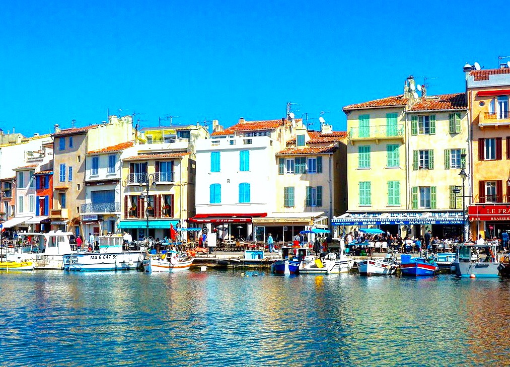
When visiting the southern part of France, the cities of Nice, Monaco, Cannes, Avignon and Provence are popular choices on traveler itineraries. However, be sure to add some of these lesser known places to your travel plans. While the French rail and bus system can get travelers just about anywhere, the best way to explore the list below efficiently is by renting a car. Travelers who are able to drive manual / stick shift cars will save money on their car rental!
The Ruins at Glanum
Just 12 miles south of Avignon lies the ancient town of Glanum. This fortified town was founded in the 6th century BCE and was then destroyed by the Alamanni (a confederation of German tribes) in 260 AD. The people of Glanum abandoned the area and moved north to found what became the present day town of Saint-Rémy-de-Provence. Saint-Rémy-de-Provence is well known as being the location in which Van Gogh spent the last years of his life.
This triumphal arch stood outside the northern gate of Glanum and was a symbol of Roman power. It was built during the reign of Augustus Caesar in approximately 14 AD.
Saint-Rémy-de-Provence
St. Remy is a charming little town a 30 minute drive south of Avignon. Spend a day wandering the streets, stopping into shops, and visiting St. Paul’s Asylum, where Van Gogh spent the last years of his life. In the Van Gogh Field, located on the psychiatric hospital grounds, there are several reproductions of the painter’s work on the actual sites where he painted them. Travelers are able to see what Van Gogh saw as he painted the scene in front of him.
In 1889, Van Gogh was likely depicting these olive trees outside the Saint-Paul Asylum in his painting “Les Oliviers” or “The Olive Trees.”
Lavender Fields
Travel about 1.5 hours east of St. Remy to visit the lavender fields near the Luberon and Sault regions. They are in bloom from June to August, which is prime tourist season for visiting this part of France. Try some of the locally made lavender honey, and bring home some lavender soap.
Gorges Du Verdon
Continue further east from Luberon to visit the magnificent Gorges Du Verdon, or “Europe’s Grand Canyon.” Park your car near the kayak and paddleboat rental, and spend an hour or two exploring this site. If you have more than two people, you may want to look into pre booking a larger boat. For small groups, there is no need to make a paddleboat reservation ahead of time.
Cassis, France
Leave Gorges du Verdon and head south towards the French Riviera. Before you get to the larger cities of Nice, Cannes, or Marseille, visit the idyllic fishing port of Cassis. Rent a boat or kayak from Cassis and swim in the blue waters of Calanque d’en Vau. If you are up for an enduring hike, trek to the beach at En Vau (secluded but a 2 hour hike each way). The boat tours from Cassis into this area are usually not allowed to dock at the beach, so, if you want to spend time on the beach itself, you will likely need to trek there.
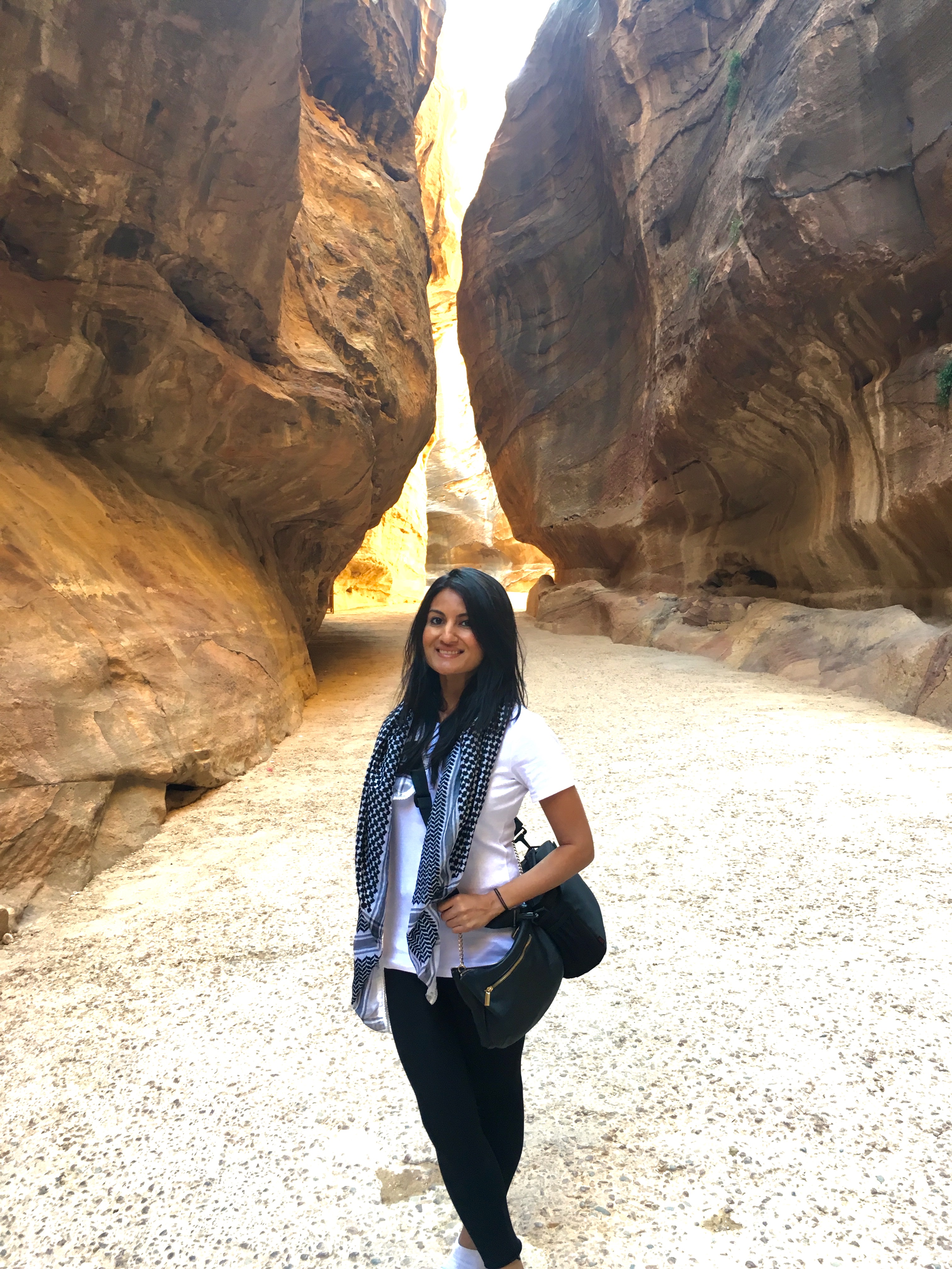
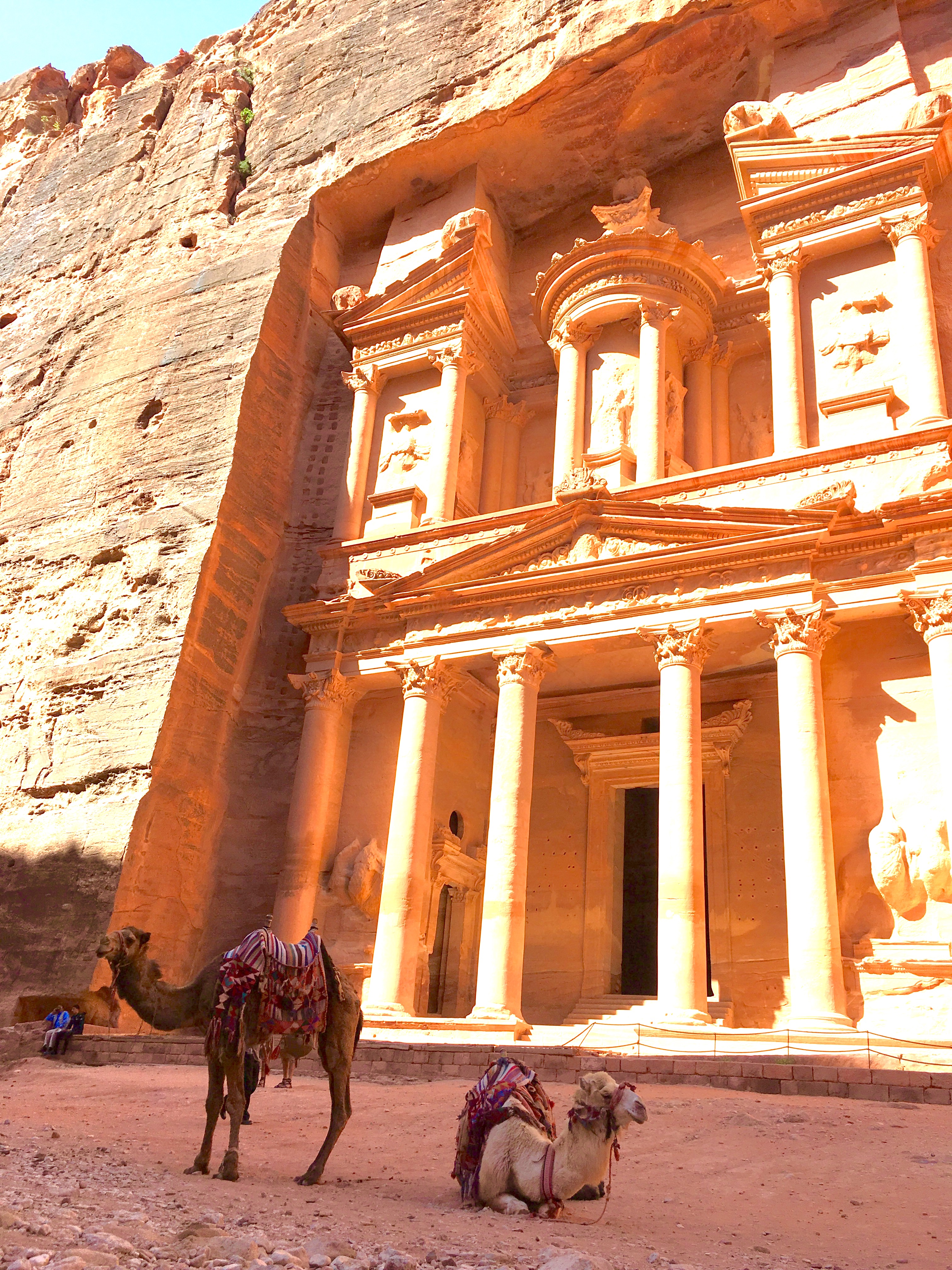
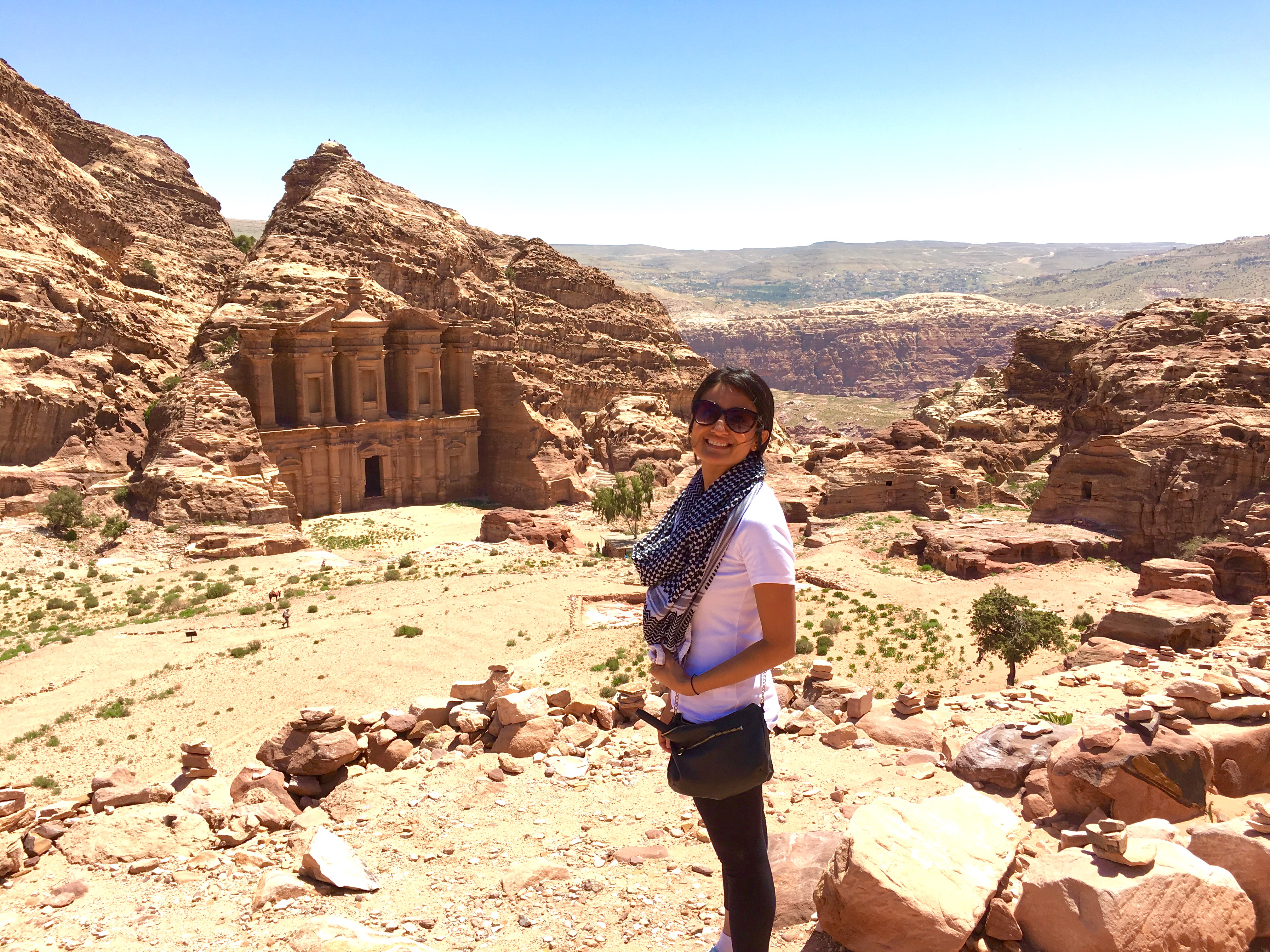
The ancient city of Petra in Jordan is famous for its architecture carved into sandstone cliffs as well as for its hidden location within the canyon landscape. Petra was established over 2000 years ago-as early as 312 B.C. Until 106 A.D., Petra was the capital of the Nabataean empire, but then soon became abandoned, and was not found again until 1812. In 2007, it was listed as one of the New Seven Wonders of the World. Travelers will need at least one full day to explore Petra, but many people spend two to three days exploring all the hidden gems of this lost city. The highlights of visiting Petra include viewing the famous Treasury (the famous scene from Indiana Jones and the Last Crusade) and hiking up to the Monastery (about 800 steps). Remember, this truly is a city- in one day, I hiked almost 10 miles and still only covered a part of it.
Walking through the canyons before arriving in the hidden city of Petra
Taking a break during my hike to the Monastery to take in the magnificent viewsAfter an 800 step climb, arrive at the enormous Monastery
How to Get to Petra
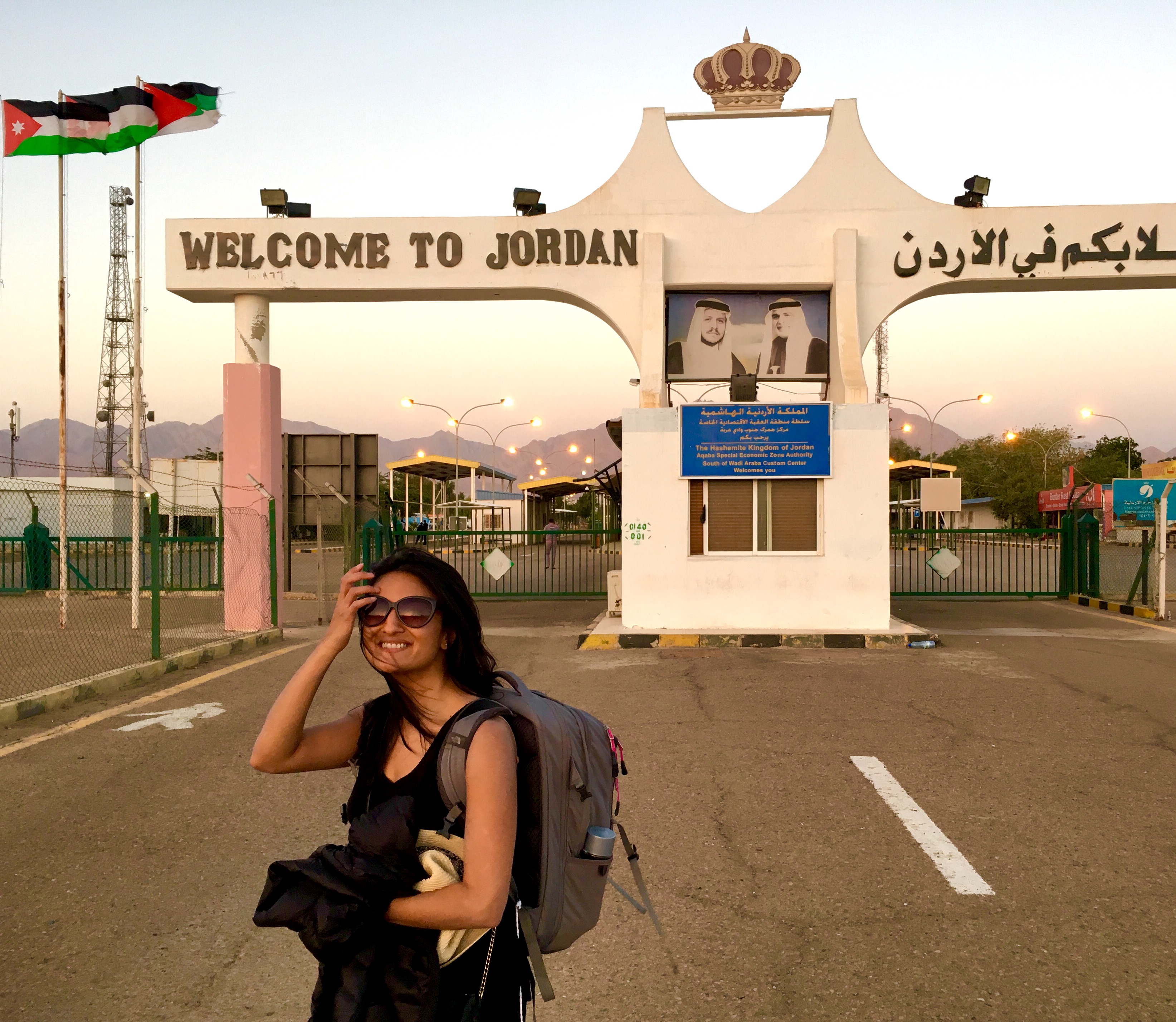
The two main ways to get to Petra are through Amman, the capital city of Jordan, or from Israel, which neighbors Jordan to the west. Direct flights to Tel Aviv are operated by Delta and El Al airways. While I enjoy arranging all my travel independently, I would highly recommend using a tour company to visit Petra. We used Desert Eco Tours, and entered Jordan from Eilat in the south of Israel. It is also possible to cross from Israel to Jordan in the northern part of Israel, however, due to the unrest in neighboring Syria, it is not recommended. Desert Eco Tours coordinated our visit from Israel to Petra – this was seamless as they also arranged for our visa into Jordan, and booked our hotels and transportation within Jordan. Once you cross the Israeli-Jordanian border on foot, your Jordanian tour guide will be waiting to pick you up on the other side. As you walk from Israel to Jordan, you will see that in just a few hundred feet, the language, culture, and religion changes – it is quite an amazing experience.
Petra Travel Tips
Bring layered clothing. The Jordanian desert is cold and windy at night, and temperatures can be scorching hot during the day. Dress modestly – women should cover shoulders and knees – this will also prevent against the intense sun during the day. You will need good shoes as Petra is vast and the climb to the Monastery (a must see) is a strenuous 1 to 2 hour climb. Stay hydrated and arrive early as it is much cooler in the morning. If you are not in adequate physical health, buggies and donkeys are available to take tourists around Petra’s sites. The tour company will assist in time management, but allow yourself at least 2 to 3 hours to cross the Israeli-Jordanian border both ways.
Best Time to Visit Petra
Spring or late Fall is the best time to visit Petra. From March to April, the temperatures are pleasant and the crowds are mild. In general, due to unrest in the Middle East, tourism has declined in Jordan. We stayed in a Bedouin Camp the night before visiting Petra, and our group of 8 were the only guests. That being said, by taking appropriate and common sense precautions and following the advice of our tour guide, we did not feel unsafe, and truly had an amazing experience. Arrive early in the morning to visit the sites to avoid the intense midday heat.
Petra’s Best Sites
The most well known site in Petra is The Treasury, which was made famous by the Indiana Jones Movie. In the movie, it seems that there is a passageway and several rooms beyond the facade. But, in reality, beyond the magnificent facade is just one empty room that was thought to be a tomb.
As you hike deeper into the lost city, be sure to make the one hour climb to the Monastery. It is an enduring hike, but well worth it.
Me and the magnificent Monastery behind me
As mentioned earlier, there are several hikes to explore all the small gems of this ancient hidden city, but the Treasury and the Monastery are the main highlights if you only have one full day in Petra (at least 6 to 7 hours). If you have more time, explore the scenic landscapes of Wadi Rum and spend a day on the Jordanian side of the Dead Sea.
El Nido is a major access point to unlocking the beauty of Palawan’s Bacuit Archipelago, which is known to have some of the most breathtaking beaches in the world. There are remote, uninhabited islands across the entire stretch of northern Palawan, and travelers will have no trouble finding stunning beaches, private coves and untouched lagoons . The town of El Nido has hospitable residents that will cook you hearty meals (either on land or during your boat rides across the islands) and welcome you graciously to their humble town.
Palawan was my first destination in The Philippines and it set the bar very high for my future trips – the hues of the water against the karst backdrop, the people, the hidden lagoons, and the amazing diving experiences for scuba lovers. I joined a Filipino family of twelve to see Palawan’s Underground River on my way to El Nido, and took a seven-hour ferry ride from El Nido to Coron. It was a blissful meditation experience to converse with a Filipino navy officer on the deck of the ferry while taking in beautiful views.
When to Visit El Nido:
Always check for typhoons, as the country is unfortunately prone to them. For the best experience, I recommended going anytime in June-August, which is off-peak season. You are taking a risk with the weather, but you can island hop without excessive crowds. Even off peak, expect at least seven to ten other tourist boats while island hopping. If you like to go off the beaten track, look up TAO Adventures and sign up for their island hopping tours that range from three to five days. They operate closer to the peak season, and take travelers to private islands.
What you need in El Nido:
Bring cash! El Nido is a small town and credit cards are not accepted everywhere. Bring your bathing suit, hat, sunglasses, sunscreen, mosquito repellant, clothes to keep you cool, and a book. Snorkeling and scuba gear can be rented but the quality is inconsistent. If you have dietary restrictions, keep those on your list of packing priorities. There aren’t too many healthy or eclectic packaged goods available at the tiny shacks here. Remember to hydrate and do not drink tap water.
How to get to El Nido:
Your options depend on your time and budget. Direct flights from Manila (MNL) to El Nido (ENI) are few and expensive for SE Asia standards (approx: $250-300). But if you are short on time, take a flight. If you have a relaxed schedule, then you have a few cool options:
1) Take a flight from Manila (MNL) to Puerto Princesa (PPS), a city at the center of Palawan. Not a whole lot to do here, but you can definitely spend a night and have a nice meal in the country’s cleanest city. You can then take a direct eight-hour road trip by minivan or bus all available at the city center or through your accommodation.
2) Travel 50 miles north of Puerto Princesa to one of the New Seven Wonders of the World: the Puerto Princesa Underground River. Explore the Underground River for a few days before you make your way up to El Nido.
3) Travel to El Nido by ferry from Manila. Ferries in The Philippines are quite comfortable (air conditioning, entertainment and food) but the rides are long and often delayed, so this is an option for the traveler with plenty of time.
Best things to see in El Nido:
Island hopping around El Nido is the number one attraction here. Rent a private boat through your hotel or private companies in town. Explore the 7 Commandos Island for snorkeling, the Secret Lagoon, Shimizu Island, Hidden Beach, Secret Beach, Talisay Island, Matinloc Shrine and Helicopter Island. El Nido itself also has some beautiful beaches accessible by foot or tricycle (their version of a tuk-tuk). These are Marimegmeg Beach/Las Cabanas Beach, 7 Commandos Beach (accessible by boat and part of one of the island hopping tours), and Corong Corong Beach. Matinloc Island now has a resort with facilities to ferry you to El Nido and back, about a 15 minute ride. This is a great stay option if you want to avoid crowds. More adventurous travelers can rent kayaks to go from El Nido to Matinloc. Scuba enthusiasts can use the company Palawan Divers to set up a dive. During my night dive, I saw a blue-spotted stingray, an egg cowry, three types of seahorses, and several nudibranchs – all quite rare. Coron is also a very popular dive spot with actual WWII wrecks to explore.
The view from Matinloc Shrine on Matinloc Island
Getting around El Nido:
Transportation is easy, as El Nido is small and you can walk to most places. Additionally, most people speak English here. If you’re staying a bit further away from shore, there are tricycles (small tuk-tuks) everywhere always looking for your business. Also, this tiny town was hit badly by Typhoon Haiyan in 2013, so a lot part of their economy still depends on you. Haggling with the tricycle driver is not needed, as unlike in Manila, they will quote you a fair price and will go out of their way to ensure you’re at the right destination.
Thanks to Shuchi Vyas, a New York-based travel expert, entrepreneur, and nonprofit consultant. Shuchi spent all of 2015 globetrotting – combining her love of travel with engaging with local communities. She assisted several organizations ranging from a small organic farm in Vang Vieng, Laos, to a large Southeast Asian nonprofit based in Manila. Her favorite experiences include diving with sharks in Malapascua, zip-lining in the northern jungle of Laos, hitchhiking in Sulawesi, and biking through villages near Angkor Wat in Cambodia. Follow her on instagram @shuch_a_wanderer
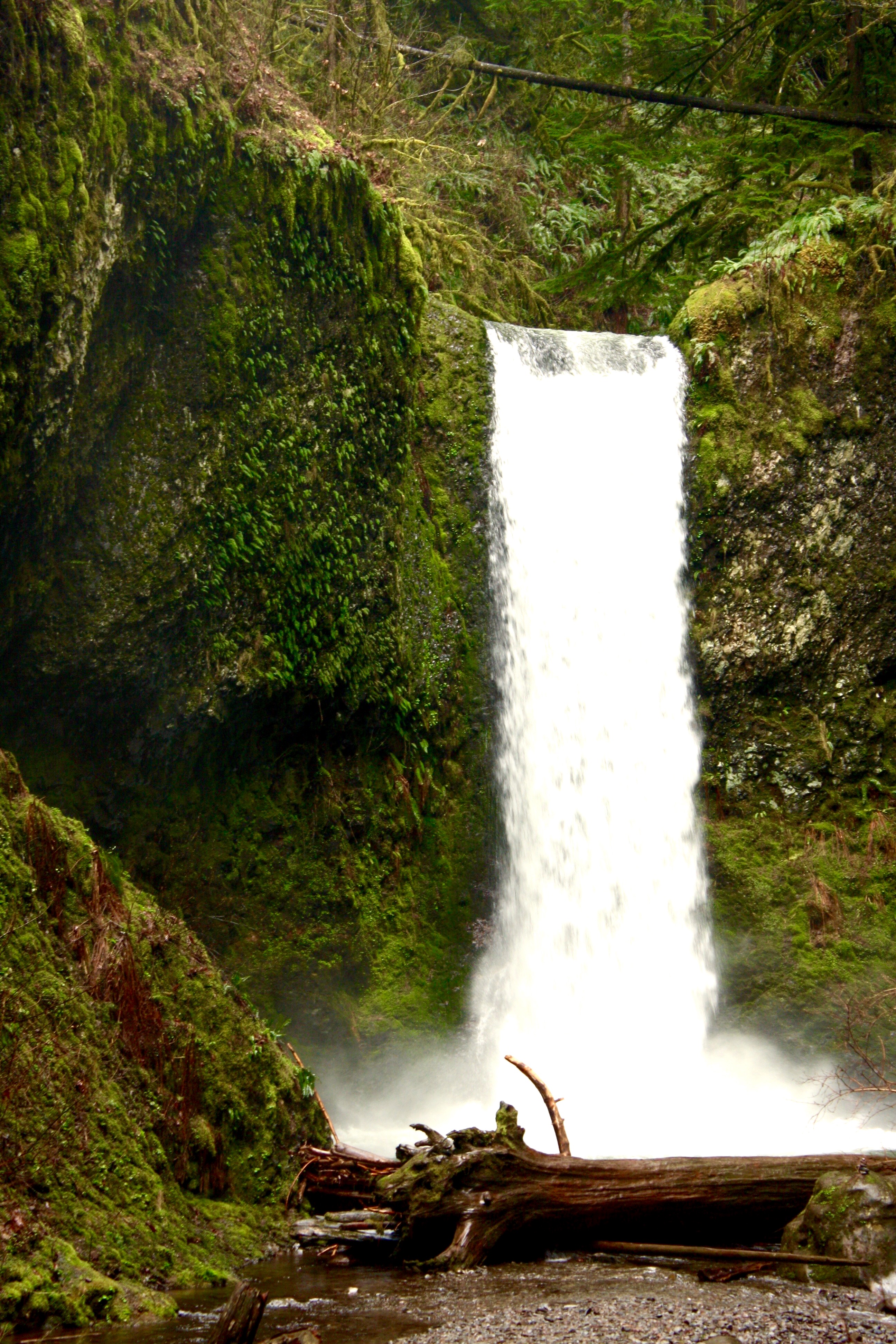
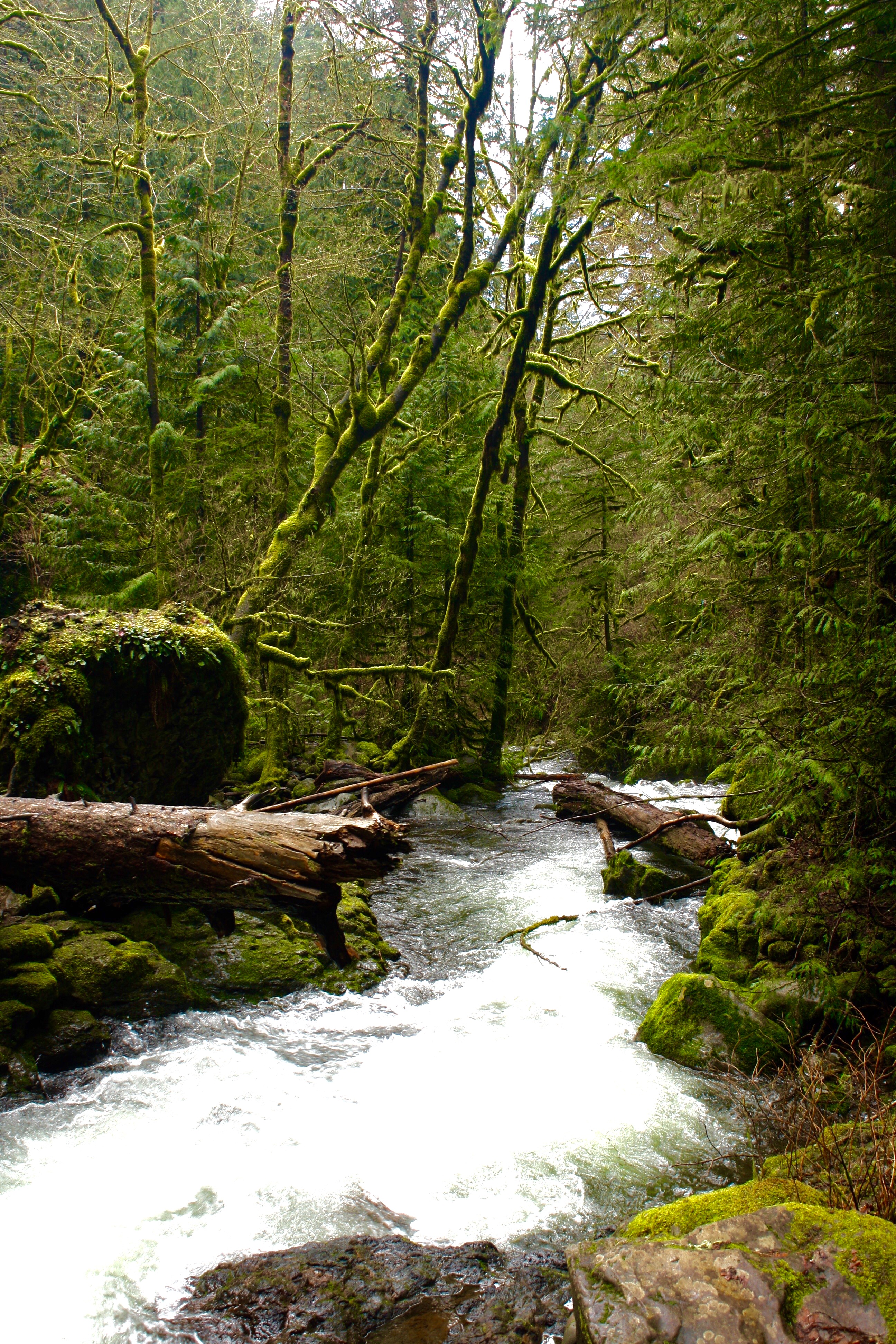
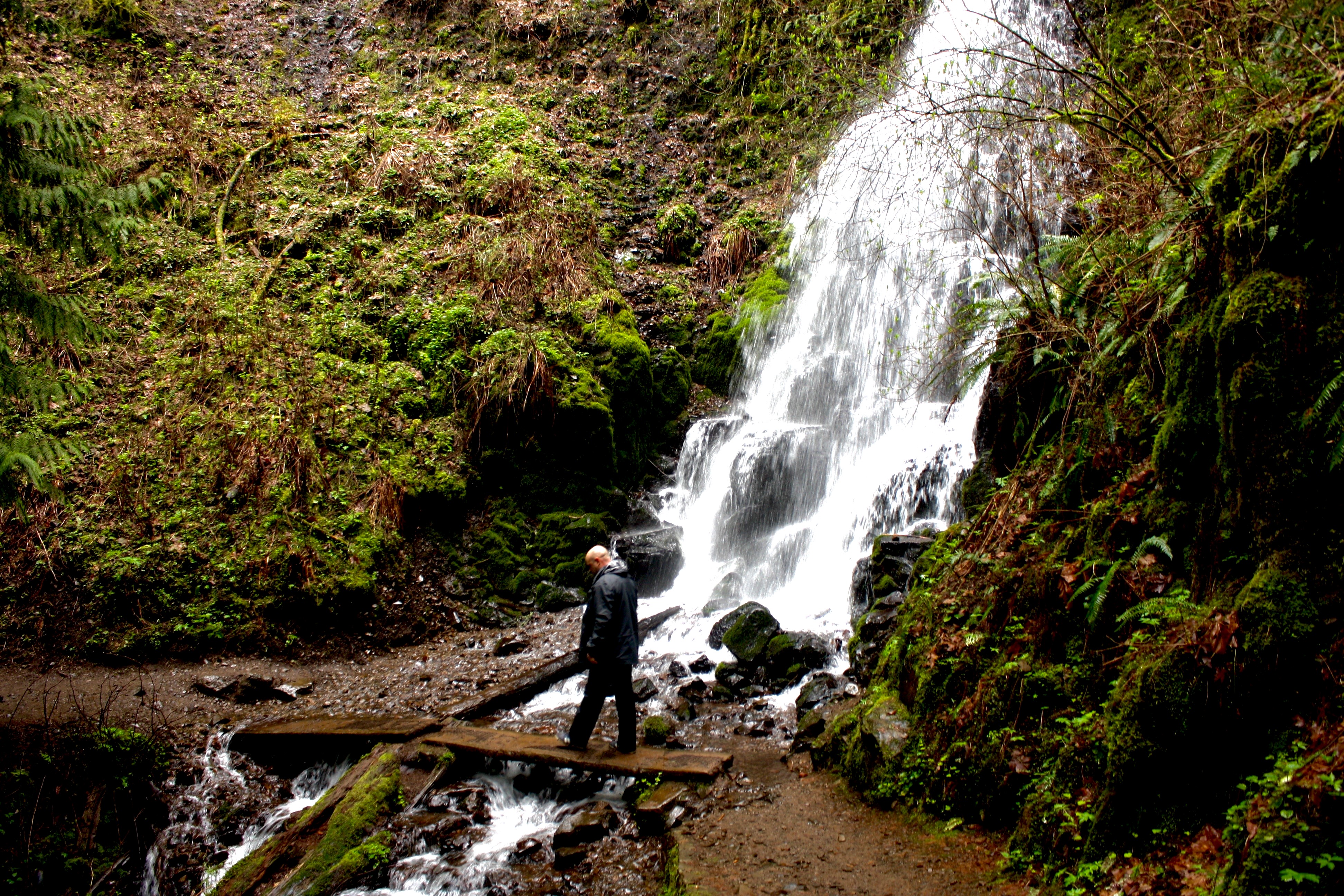
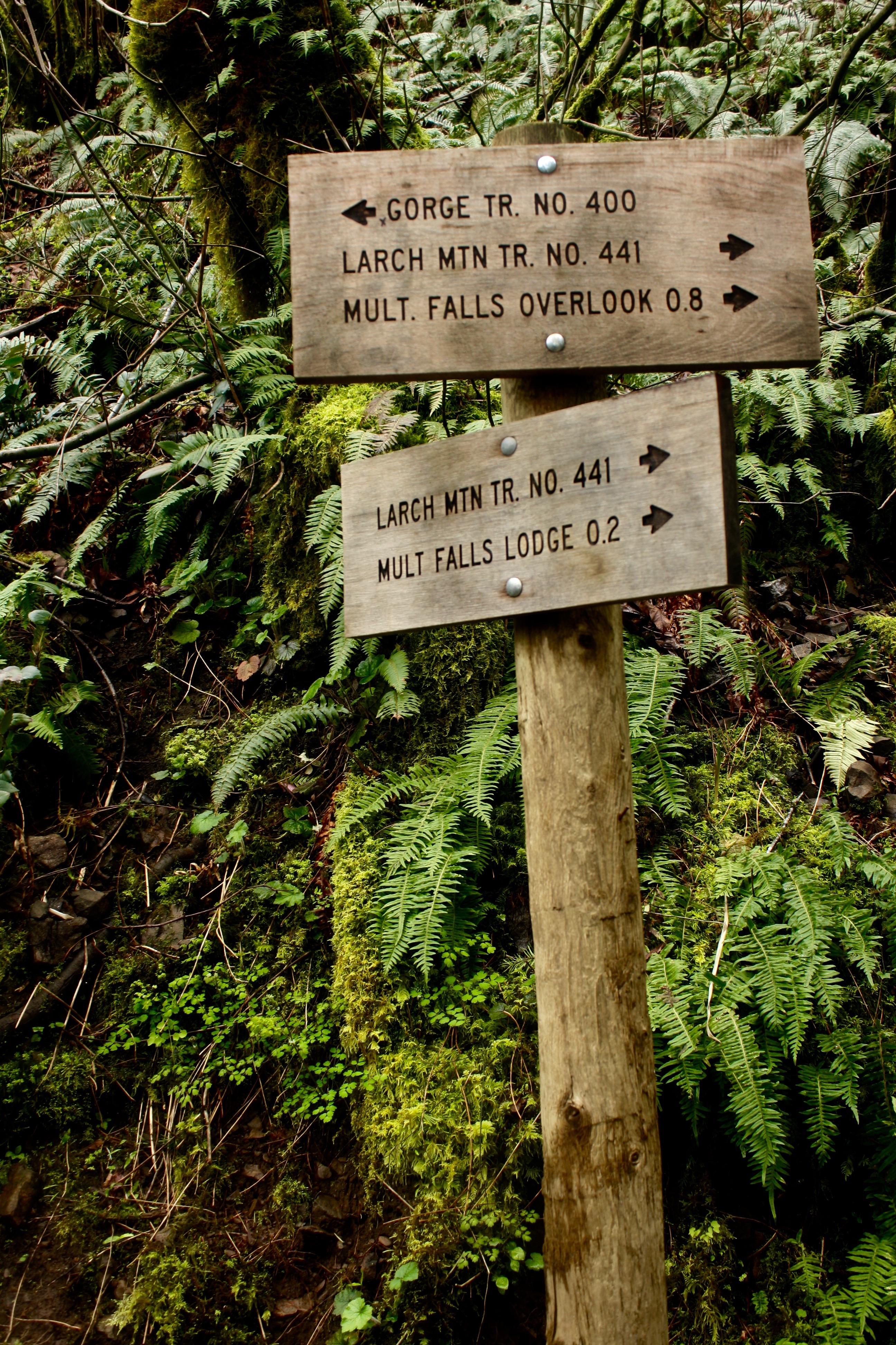
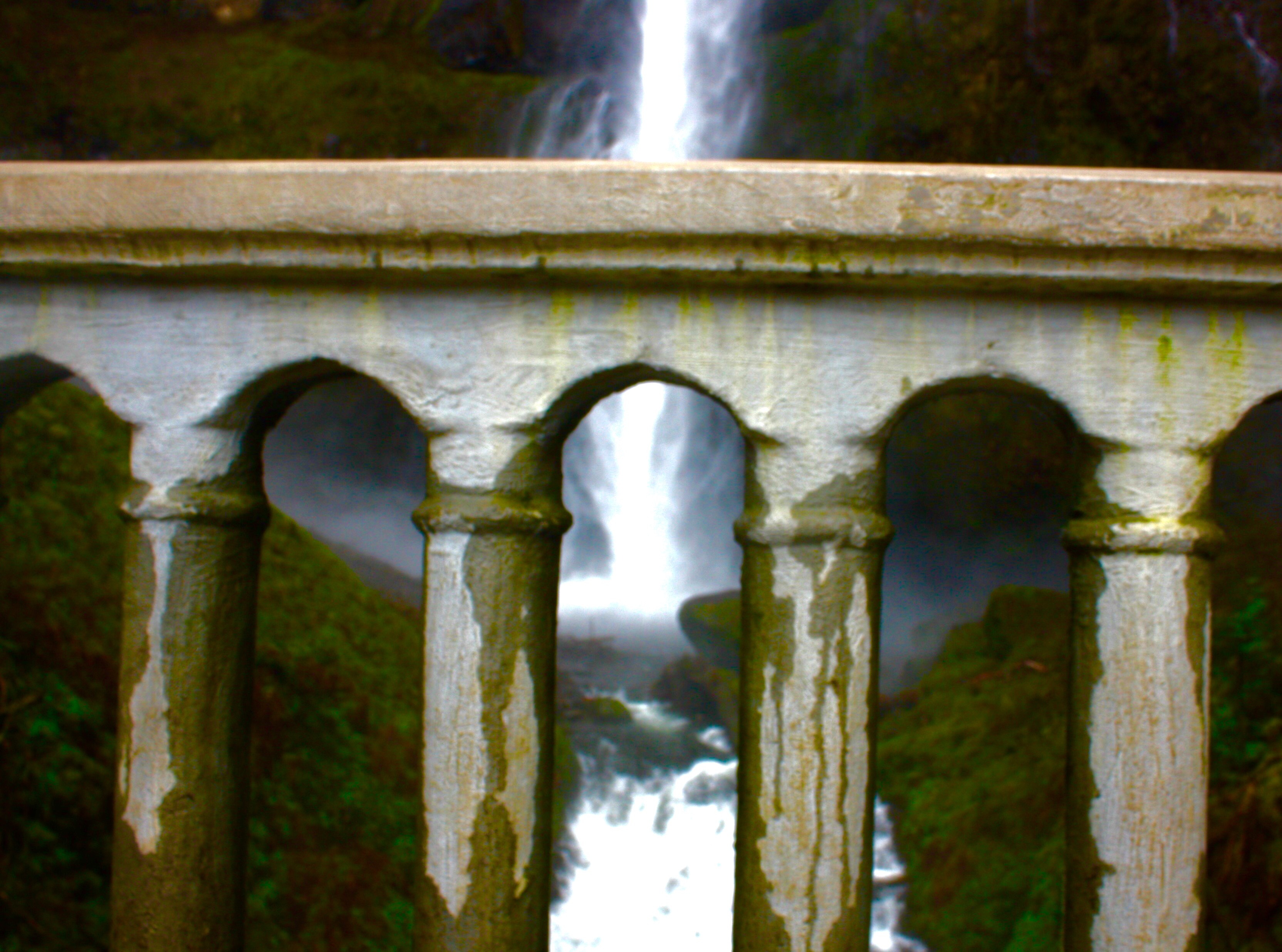
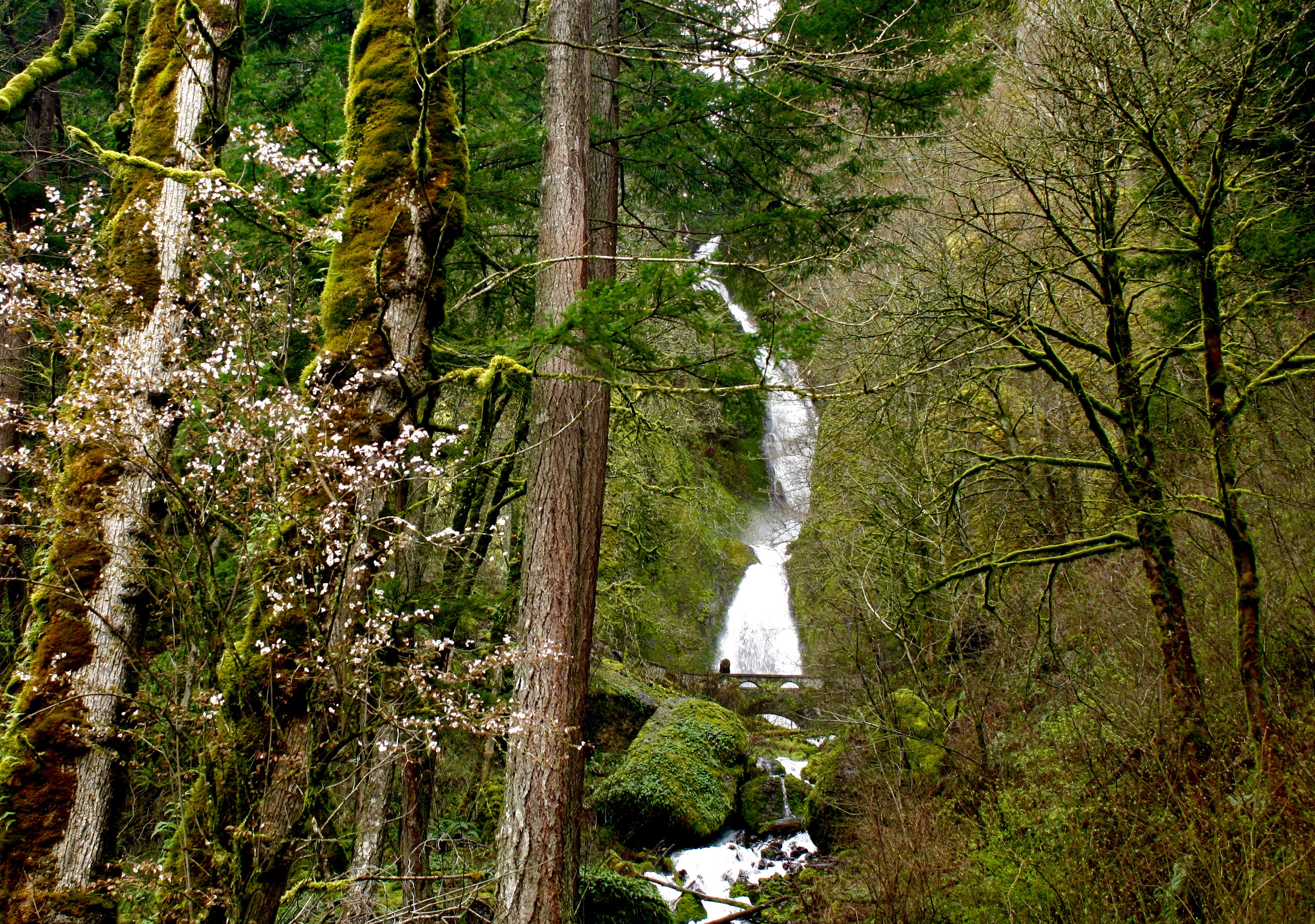
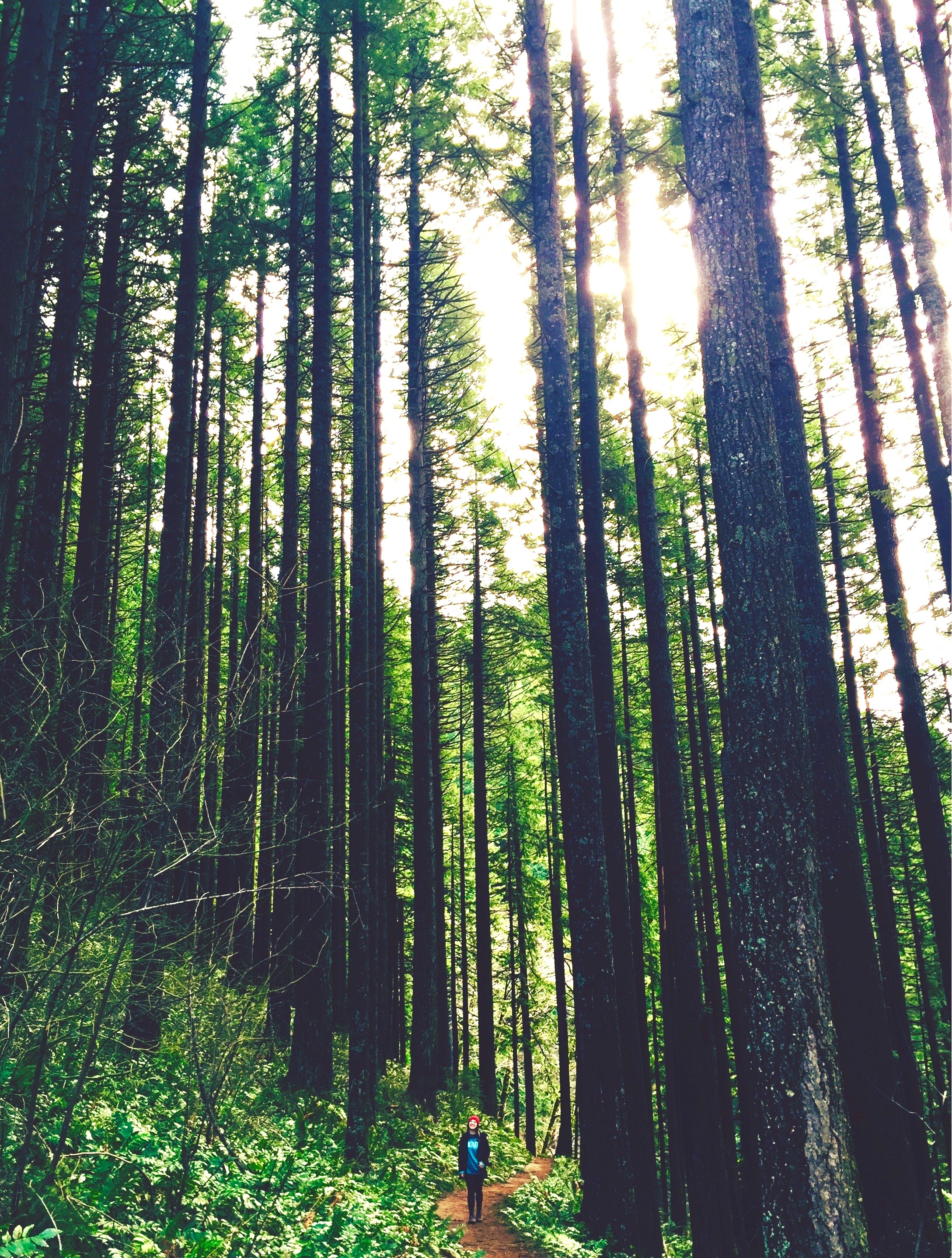
The Columbia River Gorge, in Northern Oregon, is a hiker’s paradise with breathtaking views, fairytale like forest scenes, and powerful waterfalls. The Columbia River, one of three rivers that connect the Columbia Mountain Range to the Pacific Ocean, formed this vast gorge in the mountains. One of the more popular attractions of the area is the extremely impressive concentration of waterfalls. On the Oregon side alone there are over 90 waterfalls, including the 620ft Multnomah Falls. In 1986, United States Congress named the gorge a US National Scenic Area.
This area of the Pacific Northwest has seen human civilization dating back 13,000 years when travelers from present day Asia crossed the land bridge to this region. This area has also been home to Salmon-fishers for nearly 10,000 years. The gorge has also been a great provider of transport, dating back to use by the Native Americans, and then continued use by Europeans in the steamboat industry. Today, the riverside is home to railway tracks and the Columbia River Highway.
HOW TO GET TO THE COLUMBIA RIVER GORGE
The Gorge, located near Oregon’s border with Washington state, is about 45 minutes outside of Portland. The easiest way to get to the Columbia River Gorge is by flying into Portland (Airport Code: PDX) and renting a car. There are two primary routes: the main highway or the more scenic Marine Highway. While it adds about 15-20 minuets to your drive, the Marine Highway route takes you right along the Columbia River providing scenic views throughout.
TIPS ON VISITING THE COLUMBIA RIVER GORGE
Be sure to bring a raincoat! Oregon lives up to its reputation of being a rainy place, and when you are close to the waterfalls the spray is fairly intense. Wearing layers is helpful, as some parts of the hikes are strenuous- being able to strip outer layers is very refreshing. Hikers should bring a backpack to carry extra clothes, trail snacks, and water. Hiking shoes or boots are also better than sneakers because the trails could be muddy and traction is helpful.
BEST TIME TO VISIT THE COLUMBIA RIVER GORGE
The Pacific Northwest is known for its moderate temperatures and frequent rainfall, however the rainfall is hardly incredibly heavy. The rainfall is most heavy in the winter months, so plan a visit in the summer. Summer months have an average high in the 60s and a low rainfall average of 1in. Near the waterfalls, temperatures are cooler around 50 degrees.
TOP TOURIST SITES IN OREGON
The waterfall loop at the Columbia River Gorge is about 7 miles from the bottom of Multnomah Falls, up to the top of the fall, around deeper into the forest, to the top of another large waterfall, and back down. Along the way you get incredible views of the gorge, the smaller waterfalls, and the hike itself is unbelievable. If you are not a hiker, that’s ok! There are shorter and more manageable options, including just looking at the waterfalls and driving along the highway. There is a short trail in between the two main falls. While in Oregon, be sure to also spend a a couple days in the charming city of Portland, visit Crater National Park (the only National Park in Oregon), and relax on the the picturesque Cannon and Bandon beaches.
Thanks to guest blogger Marley, a student at Drew University, for sharing her travel tips on Oregon!
Joshua tree is famous for its whimsical tree like yuccas that have spiky leaves and are indigenous to the southwestern United States. There is no one central attraction in Joshua Tree National Park- it is a vast, wild, and unspoiled desert scene with spiky Joshua trees and big granite boulders for miles. It is also an amazing destination for stargazers. Given the clear desert skies, the sunrises and sunsets are vibrant, and the starry sky looks magical at night.
BEST TIME TO VISIT JOSHUA TREE NATIONAL PARK
Temperatures for hiking at best in the spring and fall, with an average high/low of 85°F and 50°F (29 and 10°C) respectively. Summer, between May and September, is very hot – 90°F to 100°F degree highs during the day. Travelers can visit in the winter, but bring plenty of layers as the days are cooler -around 60°F (15°C) and temperatures dip below freezing at night. No matter which season, be prepared with lots of water on your hikes.
HOW TO GET TO JOSHUA TREE NATIONAL PARK
From Los Angeles (Airport code: LAX), Joshua Tree is a 2.5 hour drive. You can camp in the park, but during the winter, stay in a hotel in one of the nearby towns or use Airbnb to rent a refurbished homestead cabin. Although the cabin we rented felt remote, it was only a 10 minute drive from the village of Joshua Tree. There is a small community made up of some great restaurants and mom n pop shops in the village of Joshua Tree.
WHAT TO KNOW ABOUT VISITING JOSHUA TREE
There are no hotels in the actual Joshua Tree National Park but there are places in the nearby village- both home rentals as well as hotels. To enter Joshua Tree National Park, there is a $20 entry fee per car, which is a 7 day permit for non commercial vehicles. To learn more specifics about camping and other park fees, visit the national parks website by clicking here. Bring plenty of water for your hikes, and layered clothing depending on the time of year you are visiting. Keys View is the most popular place to watch the sunset so try to beat the parking rush and get there early!
WHAT TO DO IN JOSHUA TREE
The 49 Palms Canyon Oasis hike is on the periphery of the national park, it has its own entrance, and is without a fee. It is a 4 mile hike with beautiful elevated views of the desert, and it ends at a desert oasis.
There are a multiple of short, flat, easy hikes to choose from that take you to dams and rock formations. Some choose to hike different routes to see all the beautiful sites that the park has to offer. Others choose to post up at a campsite and rock climb in a certain area of the park all day. For intermediate hikers, Ryan Mountain is a 1.5 mi hike with a 1070 foot elevation gain. At the very top, you stand 5,456′ above the desert and the views are incredible. Looking down, it almost felt like I was surveying the ground of another planet. For sunset, visit Keys View because it is the highest point in Joshua Tree that you can drive to.
The sunset from Keys View in Joshua Tree National Park
Everyone says that they have a moment in Joshua Tree where they experience a profound sense of self-awareness and appreciation for life. I distinctly remember mine being when I was walking amongst the Joshua trees and the sky burned a pink I had never seen before. For travelers looking to escape it all, there is plenty of time for meditation and reflection while exploring this fantastic desert destination.
For nightlife near Joshua Tree – drive up to Pioneertown, a town that started as a live-in Old West motion-picture set in the 1940’s. The crowd is a fun mix of locals, LA visitors, and Joshua Tree campers. Travelers with more time can take a detour to Mecca Valley to walk the Painted Canyon trail (vibrant colors make up these canyons) and also visit Salvation Mountain, which has a massive folk art sculpture near the unique desert town of Slab City.
Thanks to Dr. Simi Singh, a physician in New York City, for sharing her travel tips on Joshua Tree National Park!
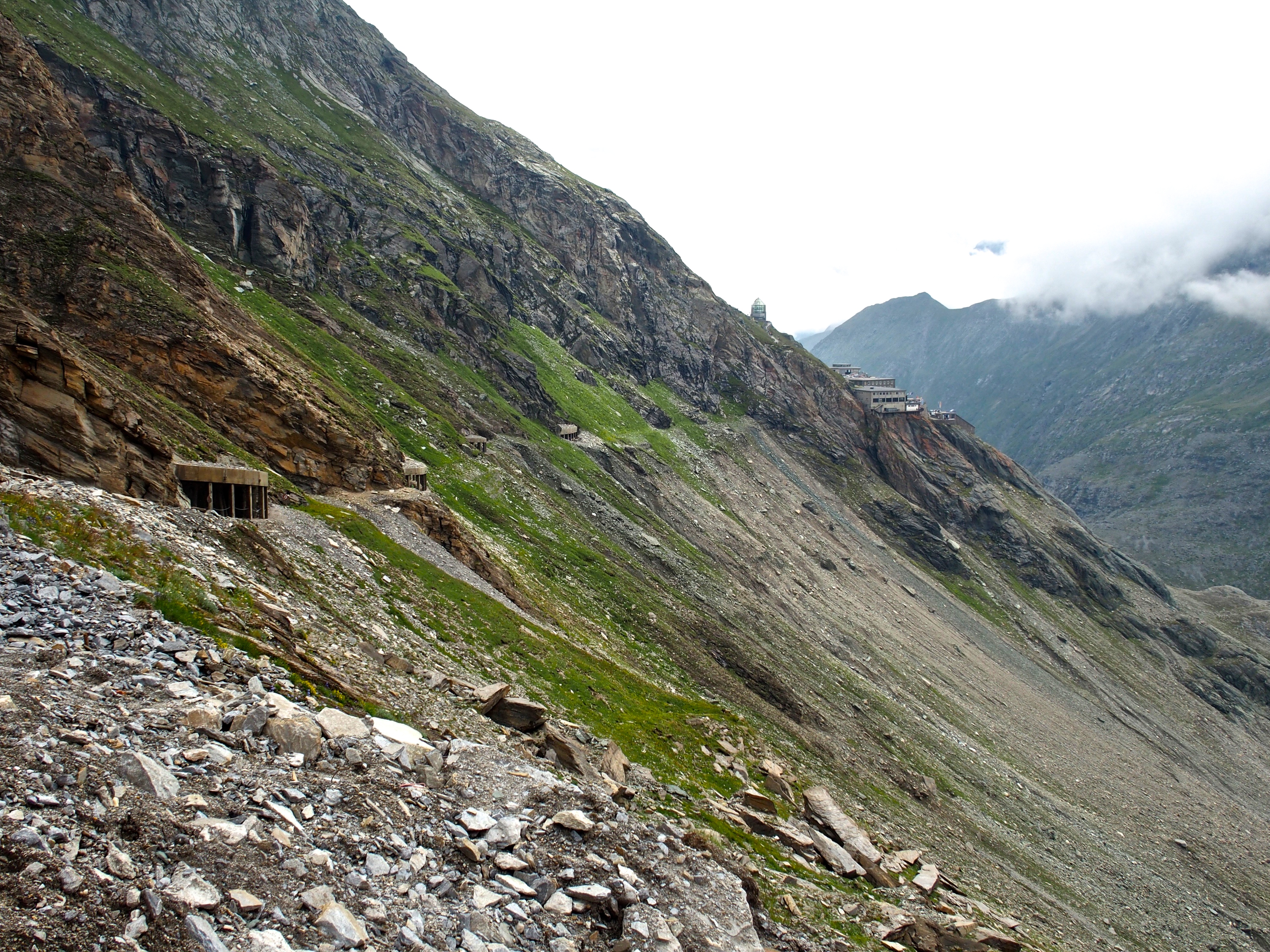
The stunning Grossglockner High Alpine Road is a 29.7 mile (47km) stretch of road offering breathtaking views of the Austrian Alps. The road bridges the two Austrian states of Salzburg and Carinthia. This scenic route is named after Austria’s highest mountain, which stands at 12,461 ft (3,787m). The road is the tallest paved mountain pass in the country, and has been meticulously constructed with a series of mountainside tunnels, switchbacks, and roads built up on stilts. It is s a thrilling drive and / or bike ride, and, fortunately, the road is in excellent condition. The optimal driving route begins at the road’s eastern entrance in Ferleiten, which is about a 1.5 hour drive south of the city of Salzburg. There you will reach the toll house; it costs 35€ per car for a day pass. From Ferleiten, the road heads westward toward the Pasterze glacier that lines the eastern slope of Grossglockner. There are many parking places along the route, most of which you can hike or bike from, and all of which promise breathtaking views of the surrounding Hohe Tauern mountain range.
Don’t tire yourself from hiking before you reach the glacier, though. When you reach the end of the road, there is a free parking garage at Kaiser-Franz-Josefs-Höhe, and from there you can choose how you want to take in the sites of the glacier and towering Grossglockner. Hiking, or taking a lift, down to the valley where the glacier lies is a popular option, and the best place to view how dramatically the glacier has receded in recent years. Another great alternative is to hike along the mountain slope to the east of the glacial valley. Continue walking towards the glacier, and you’ll journey through a series of short tunnels, that afterwards open into a mountainside path surrounded by lush greens and tiny, colorful flowers, all while overlooking the Pasterze glacier.
WHAT TO BRING TO THE HIGH ALPINE ROAD
Bring proper hiking or walking shoes; if you want to experience the utmost beauty the High Alpine Road has to offer, a good deal of walking is necessary! No matter how warm it is in the valley as you begin, once you start driving up the mountain it gets very chilly and windy, very quickly, so wear a thick jacket. Keep snacks and water handy as well!
BEST TIME TO VISIT AUSTRIA AND THE HIGH ALPINE ROAD
Due to its high altitude, the High Alpine Road is only open from May to October. In those two months, there is still a chance of encountering snow, so June through August is the best time to visit if you are interested in hiking during your visit. Between June and August, the temperatures in the valleys will range between 75 and 90 Fahrenheit (21-32 C), but as cold as 50 F (10 C) on the highest peaks.
TRAVELING TO Grossglockner High Alpine Road
The closest major airports are Salzburg (SZG), Munich (MUC) and Vienna (VIE). Non-stop flights to Austria from NYC fly into Vienna. Non stop direct flights are also available into Munich. You will have to either take a connecting flight to Salzburg or a train. Travelers can rent a car in Salzburg, or rent immediately from Munich. From Salzburg, the Grossglockner High Alpine Road is just under a 2 hour drive. If you plan to explore elsewhere in Austria, flying into Vienna is another viable option, but the drive to the High Alpine Road itself is 4 hours, versus 2.5 hours from Munich and even less from Salzburg. Renting a car is necessary to visit this road, and is best for navigating the Alpine region of Austria. Depending on how much you hike, budget 3-6 hours on the High Alpine Road.
POPULAR TOURIST SITES IN AUSTRIA
There are numerous “hütten” (cabins) and bed and breakfasts in the area to stay in, especially if you want to continue exploring the Hohe Tauern or Dachstein mountain ranges. This area is renowned for its extraordinary hiking, rock climbing, via ferrata, mountain biking, river rafting, camping, and swimming opportunities. The biggest attractions in this area include the Dachstein Krippenstein cable car, sky walk, and ice palace. The nearest cities, Salzburg and Innsbruck, also offer a range of additional outdoor activities and sightseeing.
Thanks to Devan for sharing her travels in Austria! Here is a pic of her enjoying some refreshing glacial water during her visit to the Grossglockner High Alpine Road.
The birth place of Charles Darwin’s theory of evolution, the Galapagos archipelago is considered to be one of the most pristine ecosystems in the world. The 20 (13 major and 7 small) islands here boast amazing wildlife, making it a nature lover’s paradise. Interestingly, the Galapagos archipelago was once used as a prison camp. For a long period of time, the ecosystem was not properly cared for, resulting in depletion of natural resources. Today, there is a large effort to maintain the pristine condition of the islands and care for the many species that are native to the Galapagos. Officially part of Ecuador, the Galapagos straddle the equator off South America’s west coast. The islands were formed due to the Galapagos Hotspot and the shifting of earth’s tectonic plates. In fact, the youngest islands, Isabela and Fernandina, are still being formed through volcanic activity. Each island boasts unique sites, with luscious tropical forests covering some and barren volcanic rock making up others.
Kicker Rock in the GalapagosSunset on San Cristobal in the Galapagos
When to Visit the Galapagos Islands
Average temperatures in the Galapagos range from 69°F-84°F year round. The dry season in the Galapagos (July to December) is best for scuba diving and observing the mating rituals of the Blue Footed Boobies and the Genovesa Owls. In the dry season, daytime temperatures are usually no higher than 75 degrees Fahrenheit. The wet season, in the first half of the year (January to June), has rain daily, but is warmer (air temperature is in the low 90s and water temperatures in the high 70s or 80). Keep in mind that temperatures and rainfall fluctuate between the islands due to difference in elevation and wind patterns. Peak tourist seasons in the Galapagos is from June to September and December to January. Always book well in advance as the Galapagos National Park limits the number of tourists visiting at one time.
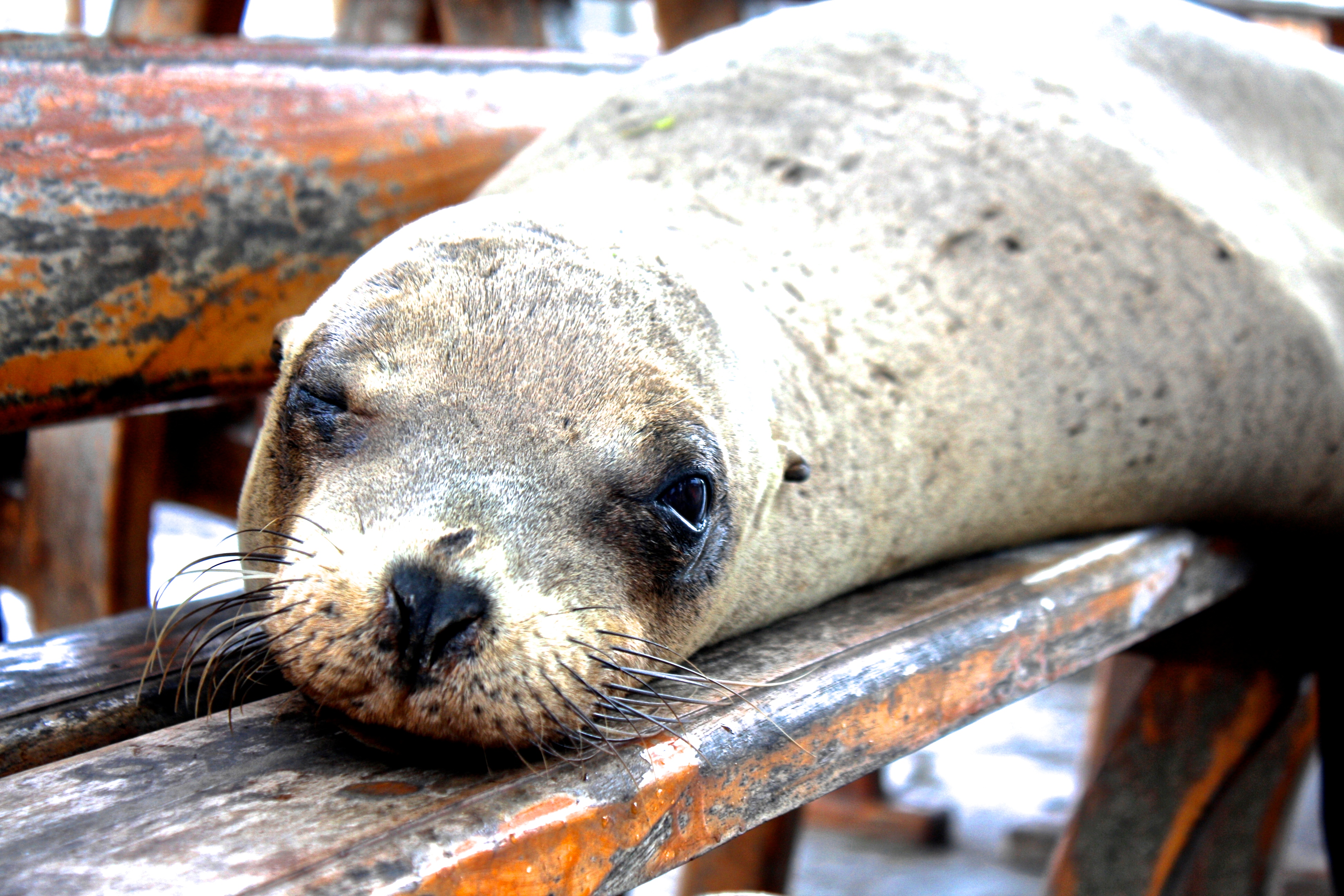
Sea Lion in the Galapagos
WHAT TO BRING TO THE GALAPAGOS ISLANDS
Travelers will need a variety of gear for this destination: swimsuit, towel, sunscreen, beach wear, followed by hiking boots, trekking pants, bug spray, and a light jacket. A pair of Teva or Chaco like sandals that can double as a beach as well as hiking shoe would also come in handy. Bring binoculars for bird watching (many exotic species here) and a camera, of course. There are plenty of places to rent snorkels, wet suits, and scuba gear in the Galapagos, so leave that at home. At the time of this post, there is a 20kg limit for checked luggage on the flight to the Galapagos.
HOW TO GET TO THE GALAPAGOS ISLANDS
There are two airports on the Galapagos Islands. The Seymour Airport on the Baltra Island (Airport Code: GPS) and the San Cristobal Airport (Airport Code: SCY) on San Cristobal Island. Direct flights to the Galapagos from Ecuador are offered from both Quito (Airport code: UIO) or Guayaquil (Airport code: GYE). There are three airlines that fly to the Galapagos Islands which are Tame, Avianca, and LAN. It is often more convenient to fly into San Cristobal and out of Baltra (or vice versa) as travelers typically do not stay on one island the entire time.
TRAVELING IN THE GALAPAGOS ISLANDS
In terms of traveling between the islands, travelers can either stay on one island and book day tours from these islands (Puerto Ayora on the island Santa Cruz is a popular hub), or book a cruise. Plan ahead, because the Galapagos National Park require visitors to be accompanied by a licensed guide. If you are hoping to see some of the more remote islands, a small cruise (duration anywhere from 3 to 10 days) is the way to go.
WHAT TO SEE IN THE GALAPAGOS ISLANDS
Kicker Rock (on San Cristobal Island) is a snorkeling site where travelers can see sea turtles, sharks, sea lions, octopus, and schools of fish. On the island of Santa Cruz be sure to visit Puerto Ayora, which is home to the Charles Darwin Research Station, El Chato Tortoise Reserve (giant wild tortoises) and the Galapagos National Park. Tortuga Bay, a short walk from Puerto Ayora, has a great beach and wildlife that includes marine iguanas, birds, and mangroves. On the island of Española, visitors can see the mating rituals of the albatrosses as well as the mating dance of the blue-footed boobies. Santiago, or James Island, is home to a sea lion species (called the fur seal) that is endemic to the Galapagos, as well as sea turtles, and several coastal birds. In the Galapagos, or the Enchanted Islands as they are often called, travelers can see wildlife that is found nowhere else on earth.
Thanks to Alissa from Villanova University for sharing her great travel tips on the Galapagos Islands!
Nestled in the northern region of Chile is the desert town of San Pedro de Atacama. Located within the Atacama Desert, the driest non-polar area (little to no precipitation) in the world, this town is centered around visiting the famous Chilean salt flat (Salar de Atacama), the red rock formations, and the picturesque lagoons. Originally belonging to Bolivia, Chile claimed this territory during War of the Pacific, and the Salar de Atacama is the largest salt flat in Chile. It is located 34 miles (55 km) south of the town San Pedro de Atacama and is surrounded by the mountain ranges belonging to the Andes. The salt flat here is one of the largest in the world at 3,000 km2 or 1,200 sq mi (the largest being the Salar de Uyuni in neighboring Bolivia). The small town of San Pedro de Atacama is great base for exploring this region of northern Chile.
The landscape surrounding the Chilean Lagunas (lakes) or Lagunas Altiplanicas located in this regionPiedras rojas (red rocks) created by volcanic lava and ash with a lagoon in the backgroundFlamencos in the Chilean salt flat or “Salar de Atacama”
When to visit Chile
Remember that summer in Chile is opposite that of the Northern Hemisphere. In San Pedro de Atacama specifically, the weather is arid and warm for several months of the year. From late October to April, the highs are in the 70s (F) and lows in the high 50s. Upon arrival, allow yourself a day or two to acclimate to the altitude before heading on any strenuous hikes.
What to wear/bring to san pedro de atacama
Since the Atacama Desert is the driest place it is important to keep yourself well hydrated. Furthermore, this town sits at approximately 7,900 feet (or about 2,400 meters). At high altitudes, boiling water for at least three minutes is the best way to purify water. Bottled water is also an option. Loose, light clothing for the day is recommended but bring a sweater for the low temperatures at night. If you are prone to altitude sickness, coca leaves can be purchased from local vendors. Remember that drinking alcohol can make altitude sickness worse. Additionally, bring plenty of cash! San Pedro is known for running out of cash in their ATMs.
How to get to san pedro de atacama
Non-stop flights to Chile (Santiago Airport Code – SCL) are available from NYC and Atlanta. Cheap flights to Chile can be obtained by choosing a one-stop option. From Santiago, fly to the El Loa Airport in Calama, which is about 60 miles (100km) away from San Pedro de Atacama. From there, take a van or taxi to San Pedro (schedule this ahead of time for ease on arrival). Travelers can also take an overnight bus from Santiago.
How to get around
Because San Pedro is such a touristy area I cannot stress the helpfulness of the travel agencies enough. Several local tour operators can arrange all the details of your visit. Compare prices at a few different agencies to ensure that you are getting a reasonable rate. To get to close by attractions and getting around town, renting a bike is a great option. Not only is it a cheap way to get around, it is a unique way to experience the landscape.
What Not to Miss in Chile
This area of Chile is famous for trekking, biking, archeological guides, astronomy tours, horseback riding, sand boarding and tours of the Lagunas. My friend and I biked to Valle de la Luna, home of the salt caverns and dunes where one can see gorgeous sunsets. The next day we went on a tour of the lagunas. During our tour of the lagunas, we experienced pastel backgrounds and striking mountain ranges. We also attended an incredible astronomy tour and workshop. As we stargazed, we learned about how to spot galaxies and their different formations. Additionally, the geysers here are a popular tourist attractions. Travelers can also spend time enjoying the hot springs in this region. Don’t forget to visit Chiloe and Patagonia while in Chile.
Thanks to guest blogger Marley, a student at Drew University with a double major in International Relations and Spanish, who hopes to leave the world better than she found it.
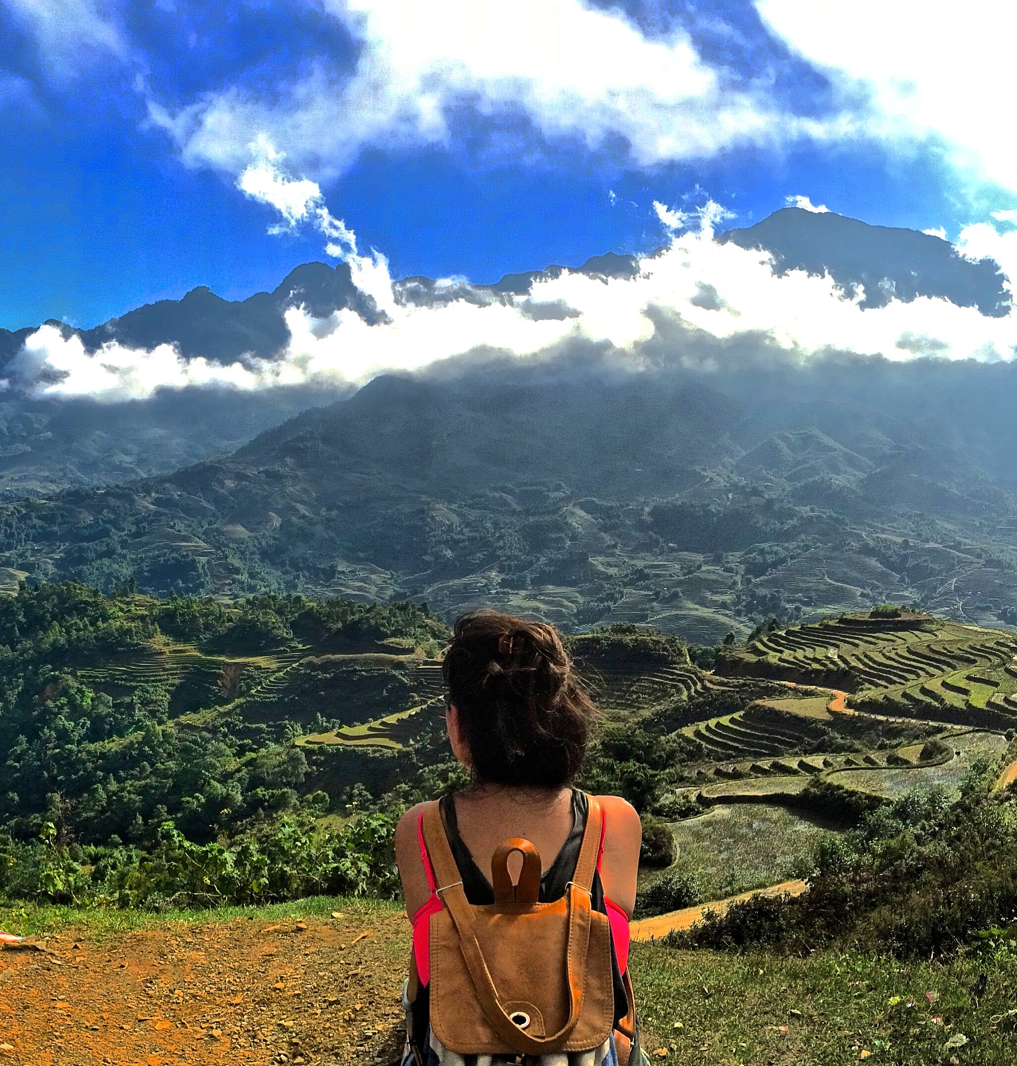
Tucked away in Northwest Vietnam, lies one of the most spectacular and lesser known regions of the world. Sapa is a township in Vietnam that is surrounded by 17 villages, some much smaller (300-3000 people) than others. Though occupied for thousands of years before the French, who first arrived in the 1800s, it was during colonial French rule that Sapa became famous as a stunning “hill station.” The true beauty of this area lies in the picturesque villages just outside the town of Sapa. I stayed in Lao Chai village. In the villages surrounding Sapa, travelers will find farms for water buffalos and rice paddy fields. When visiting Sapa, you will have spectacular views of terraced rice paddies built along the magnificent hills and mountains.
Several hill tribes live in the region of Sapa. These include not just the Kinh people, or ethnic Vietnamese, but also eight different ethnic tribes. Experiencing the culture here is just as rewarding as taking in the magnificent scenery.
The Hoàng Liên Son mountain range is found in this area and is actually the eastern end of the famous Himalaya mountain range. Fansipan, also called “the Roof of Indochina” is a mountain in Vietnam that is just 9 km from Sapa. It is 10,312 feet high (3,143 metres) and is the highest in Indochina (made up of Vietnam, Laos, and Cambodia). Trekking to the top can be arranged from local tour companies and takes 2 to 3 days. This region of Vietnam is very close to the border of China, with the train station at Lao Cai being just a 40 minute walk to the border crossing to Hekou in China.
What To Wear in Sapa, Vietnam:
Sapa has a cold climate compared to the rest of Vietnam, so bring a jacket. In January, the low can be near 50 degrees Farheinheit (10 degrees Celsius). In June, the temperature rises to the 70s (20-21 Celsius), but still not very hot at any time of year.
What to Bring to Sapa, Vietnam:
You will definitely want to bring some good hiking shoes or sneakers to take advantage of all the trekking opportunities here. A backpack, camera, and sunglasses are essentials as well.
How to get to Sapa, Vietnam:
To get to Sapa, travelers should fly into Hanoi. Cheap flights to Vietnam can be found on local Asian carriers from several cities. Direct flights to Vietnam (Hanoi airport code: HAN) can be found from London, Paris, Tokyo, Hong Kong, Shanghai, Bangkok, Seoul, Kuala Lumpur, and Guangzhou. Once in Hanoi, take the overnight train to Lao Cai train station (close proximity to the Chinese border). An overnight train costs anywhere form $20 pp – $40 pp depending on how luxurious you want it to be. Once you get to Lao Cai station, you have to take an hour-two hour car ride (depending on traffic) to Sapa. From Sapa, you can take a taxi to the village you are staying in. Travelers can just stay in Sapa, but I recommend getting out of the city life to be in the remote farmlands. A less popular option for traveling to Sapa is by an overnight sleeper bus from Hanoi. While it is only $10 (at the time of this post), road travel to Sapa is more dangerous, and the train is recommended.
What not to miss in Sapa, Vietnam:
Trekking around Sapa is highly recommended – you can get a guide when you get there for $40 for the entire day. The food here is also very famous. Locals steam the rice inside a bamboo so you crack the bamboo open to eat the rice. It was amazing!
Thanks to travel expert / global guru / doctor Simi for sharing her tips on Sapa, Vietnam!
Off the coast of southern Chile is the magical Grand Island of Chiloé. It is one of 30 islands that make up the Chiloé archipelago in the Lakes Region of southern Chile. It is the first island travelers see while crossing the Chacao Channel by ferry. The island is well known for whale watching, penguins and for its palafitos, which are colorful wooden houses on stilts along the water’s edge. There are also more than 150 iconic wooden churches from the 18th and 19th centuries, several of which are UNESCO World Heritage sites. Chiloé is 118 miles from north to south and 40 miles east to west and it’s picturesque landscape, biodiversity and rich culture will captivate any traveler.
The palafitos on the water
Due to the history of separation from the rest of Chile, Chiloé is known for having a strong sense of territorial pride. Although geographically close to the mainland, they have developed a unique culture as well as gastronomy. Additionally, the people of Chiloé are on a mission to preserve their marine resources, as well as their rain forest, which is one of the world’s few temperate rain forests. The Alfagura Project is a marine life conservation effort operated from northwest of Chiloé. Chilean whalers called blue whales “Alfaguara” and thus, the project aims to preserve the endangered blue whale species. Thanks to this project, there is a vast amount of knowledge regarding the blue whale population in this part of the world.
When I went to Chiloé my experience was defined by delicious homegrown food, breathtaking views, and a unique integration into the culture of the people. I spent a day with a shepherd, visited a woman’s artesian co-op, and toured a site where penguins come to mate for the season. My many ecotourism excursions placed emphasis on promoting a healthy and loving relationship with the earth.
When to Visit
Between December and April, travelers have the chance to see blue and humpback whales. February has the most temperate weather with the clearest skies. September through March is breeding season for the Magellanic and Humboldt penguins in Puñihuil. During Chile’s winter months (June-August) there is more rain and some national parks close due to muddy trails, so check on the websites before visiting.
Penguins in Puñihuil
What to wear/bring
Through all of Chiloé’s diversity, the one constant is rain. You will likely experience some cloudy days, misty mornings, and light rain at least once during your stay. Bring a poncho/raincoat and sturdy hiking shoes to battle the mud and rain. Also, layers are extremely important, especially when visiting the beach, as the temperature can change drastically on the coast.
How to get to Chiloé
Non-stop flights to Chile (Santiago Airport Code – SCL) are available from NYC and Atlanta. Cheap flights to Chile can be obtained by choosing a one stop option. From Santiago, travelers can fly into Puerto Montt (PMC) and then take a bus to Chiloé , or rent a car to cross the Chacao Channel by ferry. If you rent a car, the cost to cross using the ferry will be around $16. The ferry is pretty awesome because it is so beautiful and if you are lucky you will get to see some marine life! You can also take a bus directly from Santiago but this bus ride is around 15 hours. The city of Punta Arenas also offers bus service to Chiloé.
How to get around the Island of Chiloé
The best way to get navigate the different parts of Chiloé are through prearranged tours or renting a car/transportation for your time there. There is also local bus service that is frequent and inexpensive. However, if you were looking to stay the night I would recommend arranging transportation through your hotel or hostel as they often have various options at very good rates.
What not to miss in Chiloé:
The highlights of a visit to this island include whale watching, nature hikes, visiting the UNESCO World Heritage Churches, and cultural immersion. The best place to see the palafitos is in Costanera, Castro. Be sure to not miss the old growth forests in the Chiloé National Park and the penguins in Puñihuil. This is a nature lovers paradise.
Thanks to guest blogger Marley, a student at Drew University with a double major in International Relations and Spanish, who hopes to leave the world better than she found it.


You must be logged in to post a comment.