3 days in Norway

Norway is best known for its scenic beauty- in tall, strapping men as well as magnificent fjords, mountains and waterfalls. While travelers can easily spend weeks exploring Norway’s natural wonders and pristine cities, for those of us short on time, here’s a jam packed Norway itinerary to get the most out of your visit.

Day 1: Oslo

Arrive in the capital city of Oslo in the morning on an overnight flight from the U.S. Norwegian Air offers low cost no frills air to Norway and has non stop flights from JFK and Boston to Oslo. Oslo airport has direct train service to downtown Oslo and runs frequently. The “official” airport train is double the price of the local train, so if you don’t mind waiting, jump on the local train which is just as fast, but not as frequent. Book a place to stay near the Oslo train station so you can dump your bags and explore Oslo on foot. Walk over the iconic bridge near the train station and head towards the Oslo Opera House. Continue to walk along the water until you arrive at Akershus Fortress.

Sunset at Oslo Opera House

Oslo, Norway

Also known as Akershus Castle, it was built to protect Oslo and was also used as a prison. Finally head towards the Palace Park to get a view of the Parliament building. While prices in Norway are far more expensive than most countries in Europe, New Yorkers will feel right at home spending an arm and leg for fine dining.

Day 2: Norway fjords

Wake up uncomfortably early and catch the first train to Myrdal. The journey is close to 5 hours so don’t worry you can sleep for the first few hours. The scenery doesn’t start to pick up until the last two hours of the train ride.

Norway train

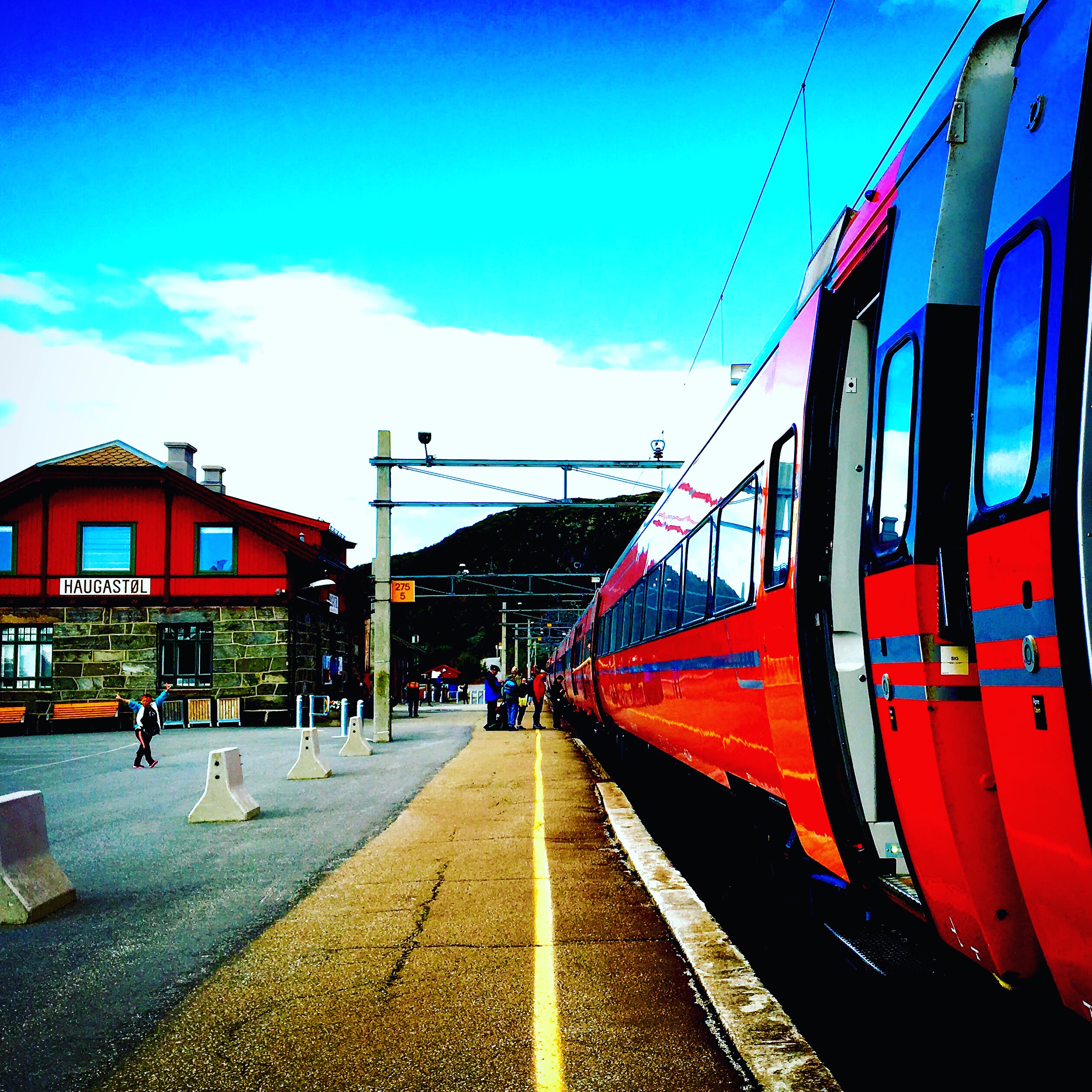
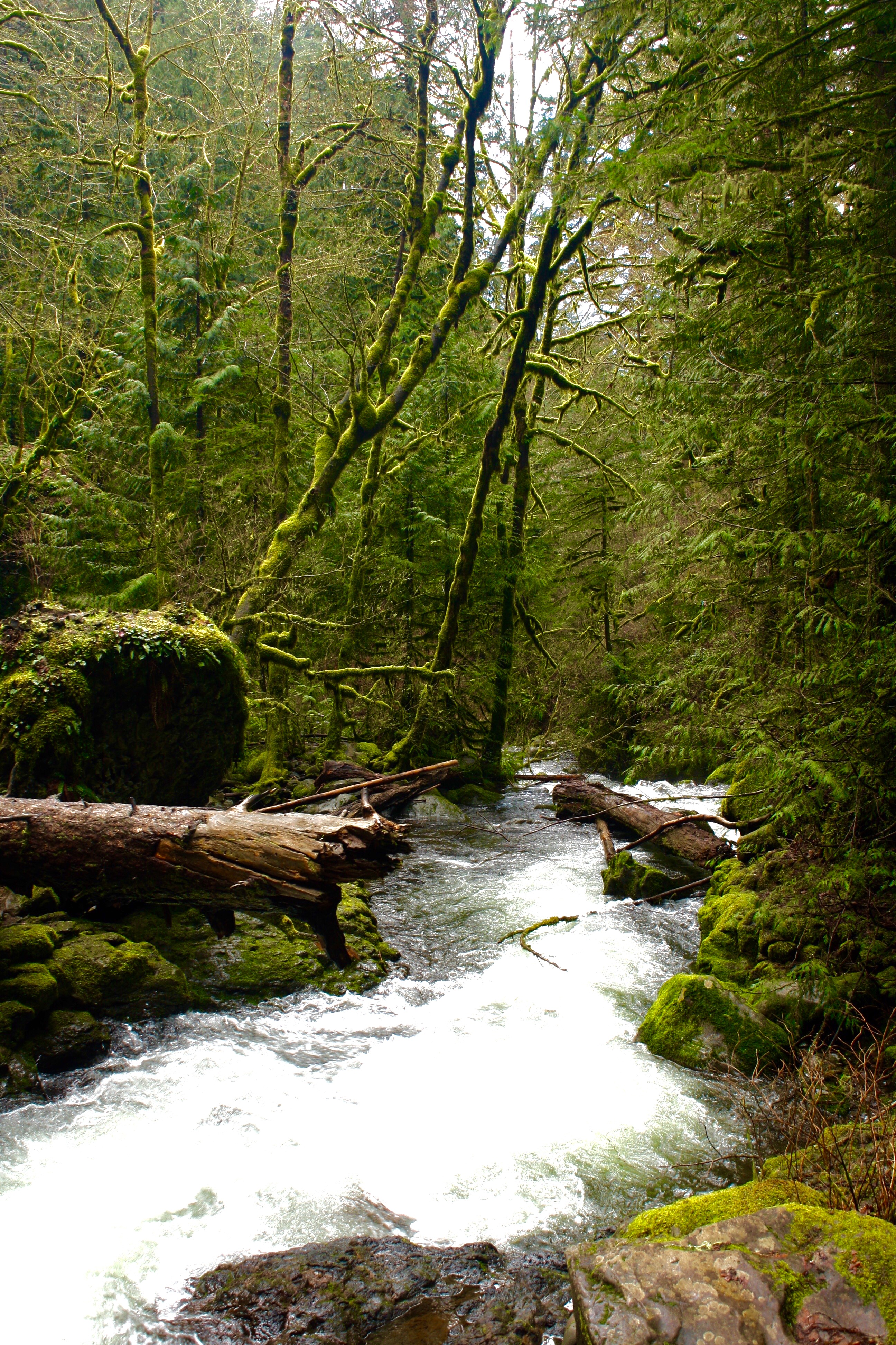
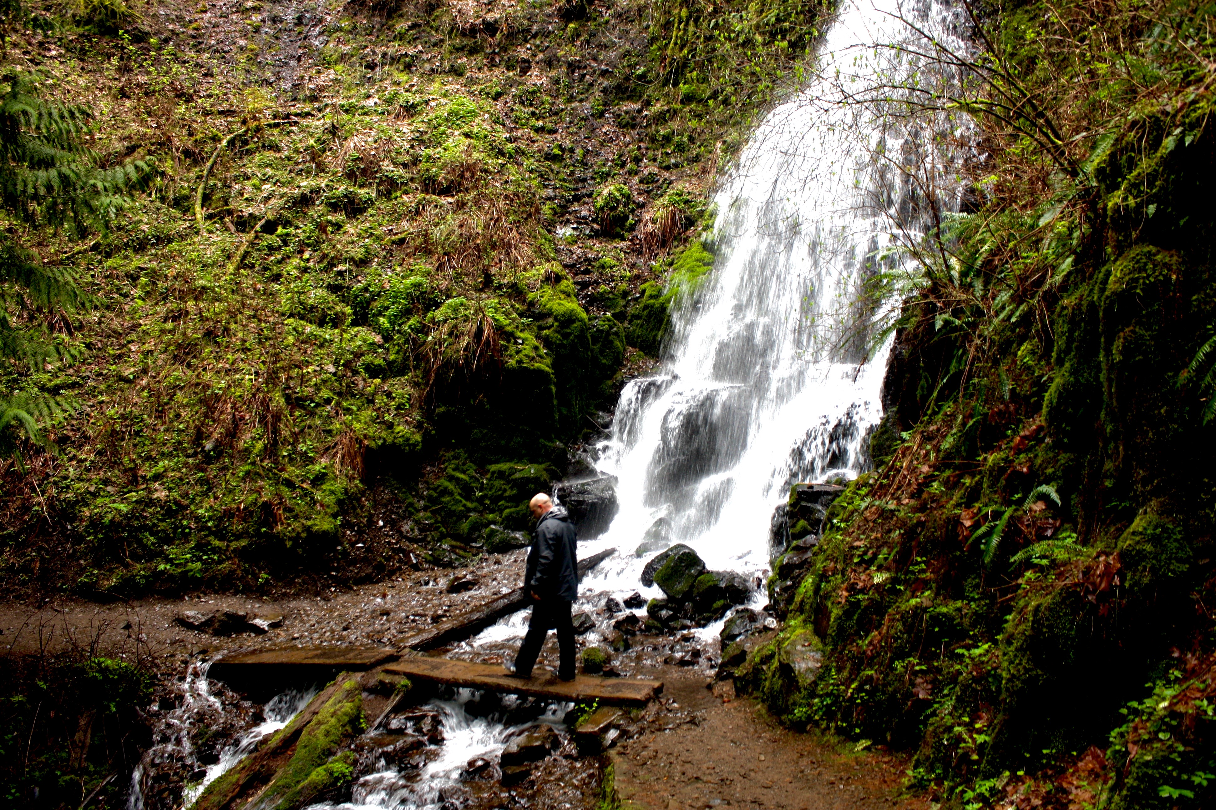
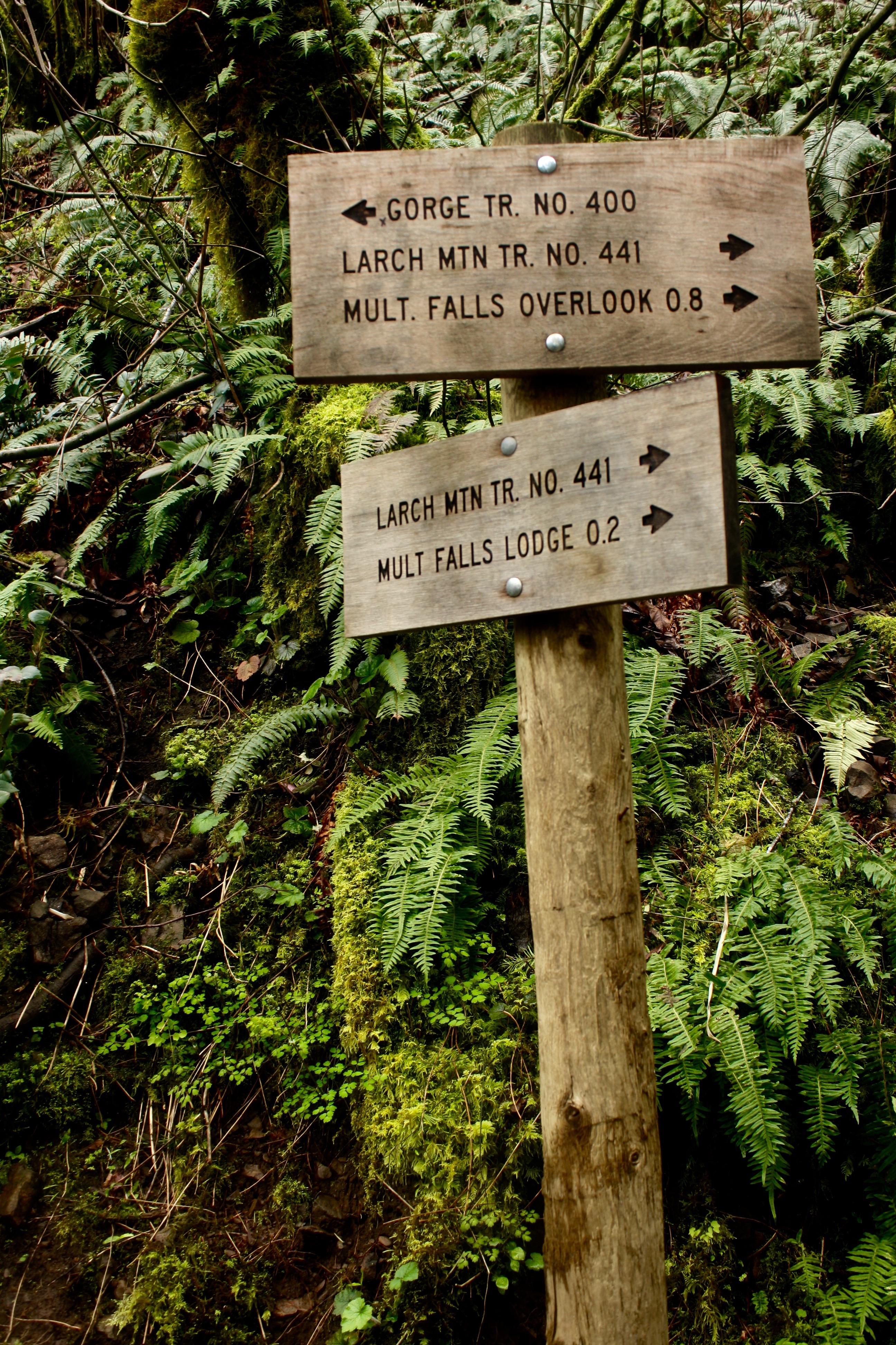
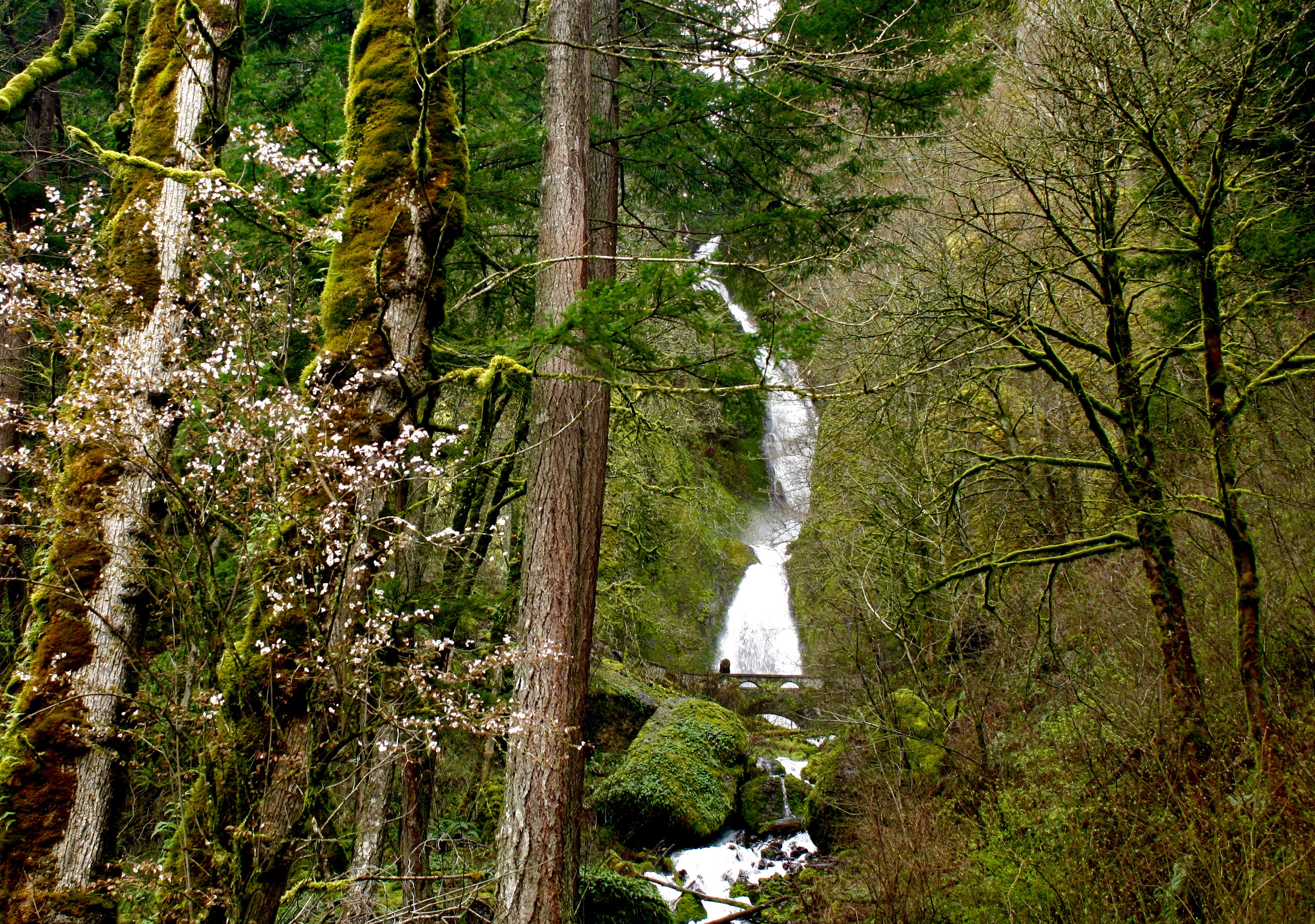
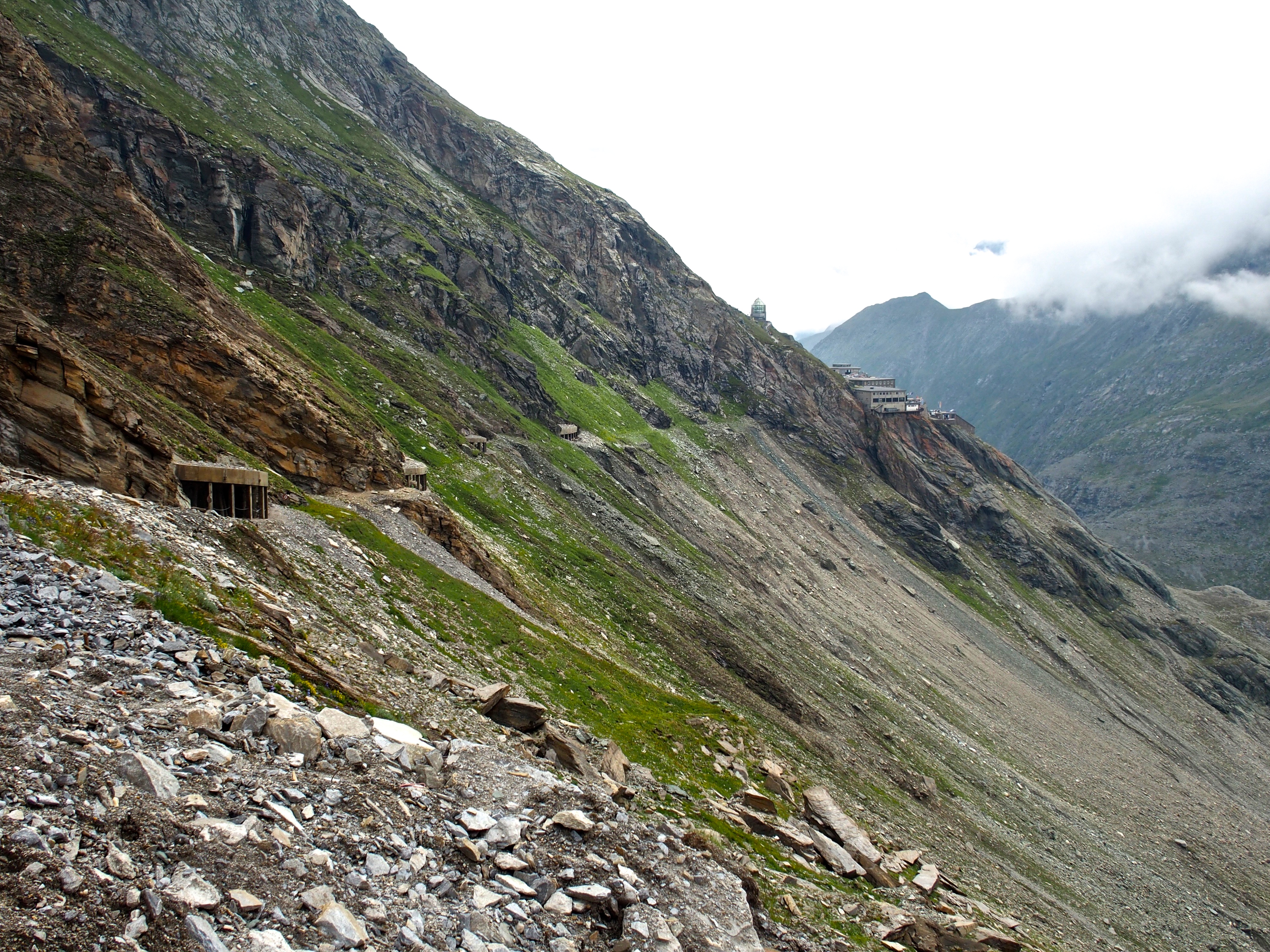
Once in Myrdal, transfer to the Flam Railway. Known to be one of the most scenic train journey’s in the world, the train travels on the edge of the mountain for 20 km and takes about 1 hour. Grab a seat with a window that opens so you can take unobstructed pictures (and selfies). The train will also make a stop so you can get off and take pictures outside a stunning waterfall.

Norway Flam Railway waterfall

Flam Railway Scenes

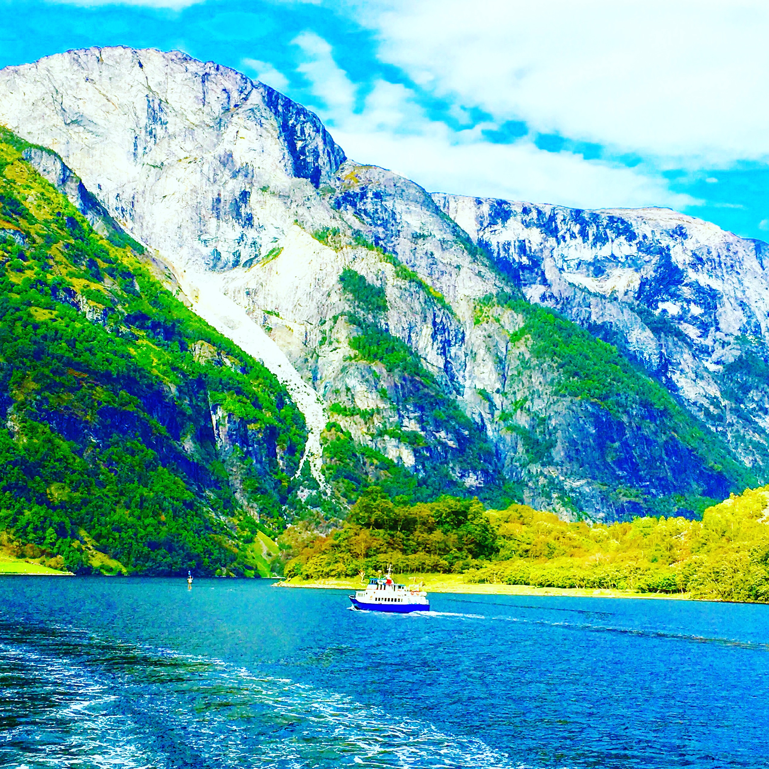
The train will put you in Flam, where you will board a fjord cruise (which will blow your mind). Weather onboard the fjord cruise will be about ten degrees colder, so pack layers. It is also very windy so hold on tight to your phones and cameras while taking photos and videos.

Norway Fjords

Norway Fjords

Following the cruise, hop on a bus to Voss and finally take the Bergen Railway from Voss to Bergen. Arrival into Bergen is close to 7 pm. The best way to book this journey is through the company Norway in a Nutshell. The most efficient option is traveling from Oslo to the city of Bergen via Myrdal, Flam, and finally Voss. The tour, around $250, has places to store your luggage on each train ride, boat ride and bus ride, plus it doubles as your transportation to the city of Bergen on Norway’s west coast. Purchasing the package through Norway in a Nutshell provides all your transfers and is the most scenic way to travel from Oslo to Bergen. Remember to pick up the tickets from the train station in Oslo when you arrive from the airport.
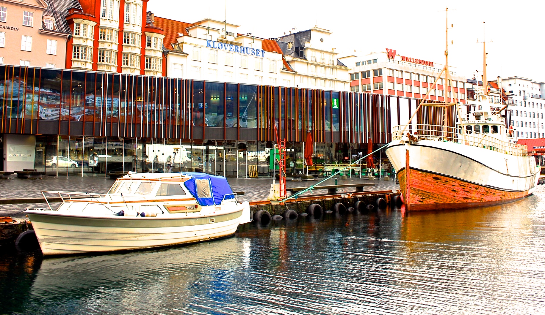
Day 3:Bergen

Spend the morning in Bergen exploring the scenic wharf area (a UNESCO World Heritage Site) and wandering the streets. The city of Bergen is set on the side of a mountain so the views from the wharf of the houses is very picturesque. You can wander up the streets, gaining elevation and views as you go or take the funicular up.

Bergen Norway

Bergen, Norway

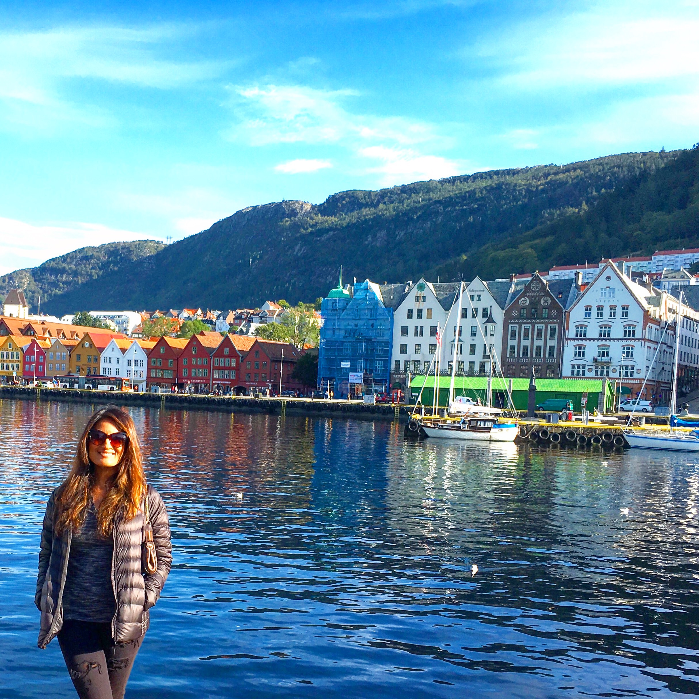
Read more about Bergen here. Bergen is not that big and can be easily explored in half a day. Norwegian air offers evening non stop flights from Bergen to JFK which will allow New Yorkers to make the the most of their day and head back to the U.S. in the evening.

Norway Travel Tips

While beautiful, Norway has the potential to get very cold. The temperature can vary greatly during the day depending on the elevation so pack layers and water resistant jackets. Bring snacks with you while traveling, and don’t be afraid to drink the water. Also the bathrooms, even in the train, are very clean so have no fear! Almost every establishment accepts credit card so do not convert too much cash before traveling. If you have more time to spare, fly to Stavanger to hike to Pulpit Rock or, if you have the guts, make the challenging trek to iconic Trolltunga. City lovers can fly direct from Bergen to Copenhagen or Stockholm to continue exploring this fantastic and pristine part of the world.

Ladakh, India

Just beyond the hill-stations of Himachal and Srinagar and just before the inhabitable upper Himalayas lies the sparsely populated region of Ladakh, the ‘Land of the High Passes’. A pocket of Tibetan culture carved into Indian borders, Ladakh is an oasis of valleys thriving amongst a harsh Himalayan ranges that slice through the land. Excursions from Leh, the sleepy, monastery-filled capital, are recommended to the Nubra Valley, a major stop in the ancient Silk Road, and Pangong Lake, a massive clear-blue lake that straddles India and China.

Ladakh India

Ladakh India

Start the morning drive early and rise out of Leh through one of the highest mountain passes in the world, the Khardung-La Pass, which peaks at a staggering 5602 meters (18,379 feet). There’s a cheeky chai station at the top reminding you that you’re on top of the world.

Ladakh India

After conquering Khardung-La, your view opens to the sanctuary that is the Nubra Valley. A small pocket of monasteries, homes, and camel farms remain of what once used to be a large trading post between China and India on the Silk Road. In the distance, the Siachen Glacier can be glimpsed where both India and Pakistan maintain forward army posts at inhumane elevations.

Ladakh India

Ladakh, India

Backtrack to Leh and cross the mighty Chang-La pass and be greeted by the colossal, shimmering-blue Lake Pangong: a saline lake that sits at 4350 meters (14,270 ft), covers 604 square kilometers, and is 134km (83 miles) long.

Ladakh India

The barren, immense moonscapes of Ladakh have an incredible way of making you feel small.

Ladakh India

When to Visit Ladakh:

The tourist season is short, from June to September with peak tourism combining with flower blooms in the valleys in late-July, early-August—a truly remarkable sight. We went in late April and combatted avalanches, blizzards, and sub-zero evening temperatures, which surely instructs you to the power of the region but is not recommended.

Ladakh India

What to Wear/What to Bring to Ladakh:

Layers are a must. After a hike to a monastery you want to rip every off, but after sitting in the car passing over 18,000 feet you’re reaching for the earmuffs. We would sleep in multiple sweaters and hibernate in winter coats. Great boots are essential. Gloves, a camera, and a penchant for adventure are all else that you need.

Ladakh India

How to get around Ladakh:

Purists would advocate renting a motorcycle and driving the entire long, unpredictable route on Royal Enfield like a Bollywood movie star. However, it’s safer and faster to fly from Delhi to Leh and hire a local driver who will skillfully transport you around the region. Of note, all foreign nationals are required to purchase the Protected Area Permit (600 INR) to enter the Nubra Valley and the Pangong Lake regions. Each town outside of Leh sports a few comfortable and affordable accommodations for you to rest after conquering each successful mountain pass.

Ladakh India

What not to miss in Ladakh:

Do not forget to give yourself time to acclimatize! The day we arrived we felt as if someone had wrung us through a clothes-dryer; we spent a full day lying in bed trying not to move a muscle. Drink water aggressively and use Diamox if you have a history of altitude sickness—acute cerebral or pulmonary edema is serious. In lighter advise, ask your driver to take you to the roads overlooking the Indus River as it runs through Ladakh. It’s a humbling experience to see the pure water make it’s way towards the coast and contemplate its role in the creation of a civilization.

Thanks to Nitish, a doctor, traveler, and writer based in New York City for his travel tips on Ladakh!

Columbia River Gorge, Oregon

The Columbia River Gorge, in Northern Oregon, is a hiker’s paradise with breathtaking views, fairytale like forest scenes, and powerful waterfalls. The Columbia River, one of three rivers that connect the Columbia Mountain Range to the Pacific Ocean, formed this vast gorge in the mountains.  One of the more popular attractions of the area is the extremely impressive concentration of waterfalls. On the Oregon side alone there are over 90 waterfalls, including the 620ft Multnomah Falls. In 1986, United States Congress named the gorge a US National Scenic Area.

columbia river gorge oregon waterfalls

This area of the Pacific Northwest has seen human civilization dating back 13,000 years when travelers from present day Asia crossed the land bridge to this region. This area has also been home to Salmon-fishers for nearly 10,000 years. The gorge has also been a great provider of transport, dating back to use by the Native Americans, and then continued use by Europeans in the steamboat industry. Today, the riverside is home to railway tracks and the Columbia River Highway.

columbia river gorge

columbia river gorge oregon

HOW TO GET TO THE COLUMBIA RIVER GORGE

The Gorge, located near Oregon’s border with Washington state, is about 45 minutes outside of Portland. The easiest way to get to the Columbia River Gorge is by flying into Portland (Airport Code: PDX) and renting a car. There are two primary routes: the main highway or the more scenic Marine Highway. While it adds about 15-20 minuets to your drive, the Marine Highway route takes you right along the Columbia River providing scenic views throughout.

columbia river gorge oregon waterfall

TIPS ON VISITING THE COLUMBIA RIVER GORGE

Be sure to bring a raincoat! Oregon lives up to its reputation of being a rainy place, and when you are close to the waterfalls the spray is fairly intense. Wearing layers is helpful, as some parts of the hikes are strenuous- being able to strip outer layers is very refreshing. Hikers should bring a backpack to carry extra clothes, trail snacks, and water. Hiking shoes or boots are also better than sneakers because the trails could be muddy and traction is helpful.

columbia river gorge oregon waterfall

BEST TIME TO VISIT THE COLUMBIA RIVER GORGE

The Pacific Northwest is known for its moderate temperatures and frequent rainfall, however the rainfall is hardly incredibly heavy. The rainfall is most heavy in the winter months, so plan a visit in the summer. Summer months have an average high in the 60s and a low rainfall average of 1in. Near the waterfalls, temperatures are cooler around 50 degrees.

columbia river gorge oregon

columbia river gorge oregon waterfall

TOP TOURIST SITES IN OREGON

The waterfall loop at the Columbia River Gorge is about 7 miles from the bottom of Multnomah Falls, up to the top of the fall, around deeper into the forest, to the top of another large waterfall, and back down. Along the way you get incredible views of the gorge, the smaller waterfalls, and the hike itself is unbelievable.  If you are not a hiker, that’s ok! There are shorter and more manageable options, including just looking at the waterfalls and driving along the highway. There is a short trail in between the two main falls. While in Oregon, be sure to also spend a a couple days in the charming city of Portland, visit Crater National Park (the only National Park in Oregon), and relax on the the picturesque Cannon and Bandon beaches.

columbia river gorge, oregon

Thanks to guest blogger Marley, a student at Drew University, for sharing her travel tips on Oregon!

Joshua Tree National Park, California

Joshua tree is famous for its whimsical tree like yuccas that have spiky leaves and are indigenous to the southwestern United States. There is no one central attraction in Joshua Tree National Park- it is a vast, wild, and unspoiled desert scene with spiky Joshua trees and big granite boulders for miles. It is also an amazing destination for stargazers.  Given the clear desert skies, the sunrises and sunsets are vibrant, and the starry sky looks magical at night.
Joshua tree 3
Joshua Tree National Park

Joshua Tree National Park

BEST TIME TO VISIT JOSHUA TREE NATIONAL PARK

Temperatures for hiking at best in the spring and fall, with an average high/low of 85°F and 50°F (29 and 10°C) respectively. Summer, between May and September, is very hot – 90°F to 100°F degree highs during the day. Travelers can visit in the winter, but bring plenty of layers as the days are cooler -around 60°F (15°C) and temperatures dip below freezing at night. No matter which season, be prepared with lots of water on your hikes.

HOW TO GET TO JOSHUA TREE NATIONAL PARK

From Los Angeles (Airport code: LAX), Joshua Tree is a 2.5 hour drive. You can camp in the park, but during the winter, stay in a hotel in one of the nearby towns or use Airbnb to rent a refurbished homestead cabin. Although the cabin we rented felt remote, it was only a 10 minute drive from the village of Joshua Tree.  There is a small community made up of some great restaurants and mom n pop shops in the village of Joshua Tree.
Joshua Tree National Park

WHAT TO KNOW ABOUT VISITING JOSHUA TREE

There are no hotels in the actual Joshua Tree National Park but there are places in the nearby village- both home rentals as well as hotels. To enter Joshua Tree National Park, there is a $20 entry fee per car, which is a 7 day permit for non commercial vehicles. To learn more specifics about camping and other park fees, visit the national parks website by clicking here. Bring plenty of water for your hikes, and layered clothing depending on the time of year you are visiting. Keys View is the most popular place to watch the sunset so try to beat the parking rush and get there early!

WHAT TO DO IN JOSHUA TREE

The 49 Palms Canyon Oasis hike is on the periphery of the national park, it has its own entrance, and is without a fee. It is a 4 mile hike with beautiful elevated views of the desert, and it ends at a desert oasis.
There are a multiple of short, flat, easy hikes to choose from that take you to dams and rock formations.  Some choose to hike different routes to see all the beautiful sites that the park has to offer. Others choose to post up at a campsite and rock climb in a certain area of the park all day. For intermediate hikers, Ryan Mountain is a 1.5 mi hike with a 1070 foot elevation gain.  At the very top, you stand 5,456′ above the desert and the views are incredible.  Looking down, it almost felt like I was surveying the ground of another planet. For sunset, visit Keys View because it is the highest point in Joshua Tree that you can drive to.
The sunset from Keys View in Joshua Tree National Park
Everyone says that they have a moment in Joshua Tree where they experience a profound sense of self-awareness and appreciation for life.  I distinctly remember mine being when I was walking amongst the Joshua trees and the sky burned a pink I had never seen before. For travelers looking to escape it all, there is plenty of time for meditation and reflection while exploring this fantastic desert destination.
Joshua tree National Park
For nightlife near Joshua Tree – drive up to Pioneertown, a town that started as a live-in Old West motion-picture set in the 1940’s. The crowd is a fun mix of locals, LA visitors, and Joshua Tree campers. Travelers with more time can take a detour to Mecca Valley to walk the Painted Canyon trail (vibrant colors make up these canyons) and also visit Salvation Mountain, which has a massive folk art sculpture near the unique desert town of Slab City.
Thanks to Dr. Simi Singh for sharing her travel tips on Joshua Tree National Park!
Thanks to Dr. Simi Singh, a physician in New York City, for sharing her travel tips on Joshua Tree National Park!

The High Alpine Road, Austria

The stunning Grossglockner High Alpine Road is a 29.7 mile (47km) stretch of road offering breathtaking views of the Austrian Alps. The road bridges the two Austrian states of Salzburg and Carinthia.  This scenic route is named after Austria’s highest mountain, which stands at 12,461 ft (3,787m).  The road is the tallest paved mountain pass in the country, and has been meticulously constructed with a series of mountainside tunnels, switchbacks, and roads built up on stilts.  It is s a thrilling drive and / or bike ride, and, fortunately, the road is in excellent condition.  The optimal driving route begins at the road’s eastern entrance in Ferleiten, which is about a 1.5 hour drive south of the city of Salzburg.  There you will reach the toll house; it costs 35€ per car for a day pass.  From Ferleiten, the road heads westward toward the Pasterze glacier that lines the eastern slope of Grossglockner.  There are many parking places along the route, most of which you can hike or bike from, and all of which promise breathtaking views of the surrounding Hohe Tauern mountain range.

Grossglockner High Alpine Road

Grossglockner High Alpine Road

Grossglockner High Alpine Road

Don’t tire yourself from hiking before you reach the glacier, though.  When you reach the end of the road, there is a free parking garage at Kaiser-Franz-Josefs-Höhe, and from there you can choose how you want to take in the sites of the glacier and towering Grossglockner.  Hiking, or taking a lift, down to the valley where the glacier lies is a popular option, and the best place to view how dramatically the glacier has receded in recent years.  Another great alternative is to hike along the mountain slope to the east of the glacial valley.  Continue walking towards the glacier, and you’ll journey through a series of short tunnels, that afterwards open into a mountainside path surrounded by lush greens and tiny, colorful flowers, all while overlooking the Pasterze glacier.

Grossglockner High Alpine Road

Grossglockner High Alpine Road

WHAT TO BRING TO THE HIGH ALPINE ROAD

Bring proper hiking or walking shoes; if you want to experience the utmost beauty the High Alpine Road has to offer, a good deal of walking is necessary!  No matter how warm it is in the valley as you begin, once you start driving up the mountain it gets very chilly and windy, very quickly, so wear a thick jacket. Keep snacks and water handy as well!

BEST TIME TO VISIT AUSTRIA AND THE HIGH ALPINE ROAD

Due to its high altitude, the High Alpine Road is only open from May to October.  In those two months, there is still a chance of encountering snow, so June through August is the best time to visit if you are interested in hiking during your visit. Between June and August, the temperatures in the valleys will range between 75 and 90 Fahrenheit (21-32 C), but as cold as 50 F (10 C) on the highest peaks.

TRAVELING TO Grossglockner High Alpine Road

The closest major airports are Salzburg (SZG), Munich (MUC) and Vienna (VIE).  Non-stop flights to Austria from NYC fly into Vienna. Non stop direct flights are also available into Munich. You will have to either take a connecting flight to Salzburg or a train. Travelers can rent a car in Salzburg, or rent immediately from Munich. From Salzburg, the Grossglockner High Alpine Road is just under a 2 hour drive.  If you plan to explore elsewhere in Austria, flying into Vienna is another viable option, but the drive to the High Alpine Road itself is 4 hours, versus 2.5 hours from Munich and even less from Salzburg.  Renting a car is necessary to visit this road, and is best for navigating the Alpine region of Austria.  Depending on how much you hike, budget 3-6 hours on the High Alpine Road.

POPULAR TOURIST SITES IN AUSTRIA

There are numerous “hütten” (cabins) and bed and breakfasts in the area to stay in, especially if you want to continue exploring the Hohe Tauern or Dachstein mountain ranges. This area is renowned for its extraordinary hiking, rock climbing, via ferrata, mountain biking, river rafting, camping, and swimming opportunities.  The biggest attractions in this area include the Dachstein Krippenstein cable car, sky walk, and ice palace.  The nearest cities, Salzburg and Innsbruck, also offer a range of additional outdoor activities and sightseeing.
Grossglockner High Alpine Road
Thanks to Devan for sharing her travels in Austria! Here is a pic of her enjoying some refreshing glacial water during her visit to the Grossglockner High Alpine Road.

Bergen, Norway

On Norway’s western coast, the charming city of Bergen is often referred to as ‘the gateway to the fjords’. In 1979, the Bryggen Hanseatic Wharf was named a UNESCO World Heritage site because of its rich history as a major Hanseatic trading center. The colorful houses and shops here, against the backdrop of mountains, make Bergen a truly picturesque destination. As you wander through Bergen’s cobblestone streets, visitors can enjoy views of the seven surrounding mountains. Bergen is constantly bustling with travelers from all over the world, most whom will visit the wharf as well as the fjords during their stay.

Bergen Norway

Bryggen Hanseatic Wharf

HOW TO GET TO BERGEN

Nonstop flights to Bergen, Norway (Airport code: BGO) can be found from Oslo, London, Copenhagen, and Amsterdam. Another popular option is to fly into Norway’s capital, Oslo (Airport code: OSL), and take a scenic 6 hour train ride to Bergen. Norwegian airlines tends to offer cheaper flights to Oslo than SAS airlines. From the airport, travelers can reach downtown Bergen by taxi, rental car, bus and, soon, the tram. The tram system is currently being expanded to reach the airport. Most hotels are located in the heart of the downtown are. If you plan on using public transportation, the cheapest pass available costs about 4 USD and is valid for 90 minutes, or purchase a 7 day pass at 28 USD.


Bergen Norway

WHEN TO VISIT BERGEN

The warmest month is July (average temperature of 66F / 19C) and the coldest is January. Fjord boat tours are available all seasons, but a larger variety are offered in the summer. Visiting in the winter is restrictive- with only 7 hours of daylight, visiting the fjords will be a rushed experience. Summer, with nearly 18 hours of daylight, is the most popular time for tourists. On the 17th of May the country celebrates it’s national day with parades, food markets, and natives dressed in traditional Norwegian garb.

TOP SITES TO SEE IN NORWAY

The Norwegian fjords should not be missed when visiting Norway. Bergen is often used by tourists as a stopover before and after visiting the scenic fjords. A fjord is a long and narrow inlet of the sea between high cliffs, and the ones in Norway are spectacular. In the summer, which is the most popular time to travel to Norway, do not forget to plan ahead for a boat cruise into the fjords. In Bergen itself, one of the most popular attractions in Bergen is the FlØibanen Funicular. The funicular runs year round and offers sweeping views of the city area. It costs 90Kr for a round trip which is about 10 USD. There are many hiking trails at the peak of FlØyen, a lake, a restaurant and a souvenir shop. Spend time wandering around the many shops and restaurants along the historical wharf and take some pictures of the classic colorful wooden houses. Along the canal is a large outdoor fish markets that sell fresh caught seafood, fruit and vegetables.

Bergen norway


Bergen Norway

Bergen Norway

THINGS TO KNOW WHEN VISITING NORWAY

The weather in Norway is cool and often cold, so bring plenty of layers. If you are counting on alcohol to keep you warm, know that it is expensive when purchased at restaurants. A domestic beer can cost around 9 USD for a pint. ‘Applesin’* means orange in Norwegian. Applesin is extremely popular and is found just about everything-tea, ice cream, syrup, jelly, and candy. If visiting during the summer months, book your boat cruise ahead of time to guarantee availability on your desired date of travel.

Bergen Norway

Bergen Norway

Thanks to travel expert Madelyn for sharing her tips on Bergen!


Cusco, Peru

Situated in the Peruvian Andes, Cusco, often spelled Cuzco, is a charming town of 350,000 and a UNESCO World Heritage Site. Often a stop for altitude acclimation before heading to Machu Picchu, Cusco itself has a lot to offer also. Built atop the ruins of the Capital of the Incan Empire from the 15th century, Cusco has a very rich history with its own Incan ruins-Sacsayhuaman and Qurikancha. The Historic District is full of beautiful churches and colonial style architecture. Outdoor enthusiasts will be amazed by the scenic trekking and beautiful sites, and the night owl can experience the local discotecas. The sky here is speckled with peaks from the Andean Mountain Range and you can appreciate this as you stroll through the city, visit the churches, shop in the markets, and meet travelers from around the world. In one day, I met a man from Scotland, a student from Hungary, and two women from Brazil. In your journey to Machu Picchu, be sure to leave a couple days (and at least one for altitude sickness) for Cusco!

Church of Santo Domingo in Cusco
Church of Santo Domingo in Cusco with the official flag of Cusco

The Best Time to Visit Cusco

The average temperature in Peru’s winter is 67.1°F, and there is an average temperature of 67°F in the summer months. The best time to visit Cusco is between June and September (summer), which are the driest months. However, a word of warning to travelers, because Cusco is such a popular tourist destination with millions of tourists flocking to the city every year to visit the nearby Machu Picchu, tourist season can get very crowded! Hostels and tourist attractions often raise their prices during peak season. If you are looking to avoid some of the crowds, travel in May or October, to have a better chance at dry weather and less crowds.

What to Bring to Cusco

Situated at 3,400 meters above sea level (11,000 feet), Cusco is not the typical tropical climate that many think of for a South American destination. Though daytime temperatures are mild year round in the mid to upper 60s, the nights can drop into the 30s-40s. Given the variability, layers are definitely the way to go! Excursions in Peru require light weight trekking pants, and light weight long sleeve shirts, which also helps to minimize the number of bug bites. Also, if you are planning on doing a trek to Machu Picchu, pack hiking boots, hiking gear, walking sticks (optional), and rain gear (plus a backpack cover). For travelers intending to trek to Machu Picchu, some hostels offer lockers to store unnecessary belongings while on the trail. It is not uncommon to have issues with altitude sickness, but luckily the abundance of products made with coco leaves (natural remedy for altitude sickness) are available at every corner. Travelers can also talk to their doctor about a prescription for acetazolamide for altitude sickness.

How to Get to Cusco

Direct flights to Cusco arrive mostly from Lima (airport code: LIM), Peru’s capital. The non-stop flight from Lima to Cuzco takes just under one hour. Alejandro Velasco Astete International Airport (airport code: CUZ) is a 10 minute drive from the historic center of Cusco. Cusco’s new airport, Chinchero International Airport, could open as early as the end of 2016. All flights will eventually be transferred to the new airport, but for now you are likely to fly into the older one. The only official taxi company is Llama Taxis, which has a booth in the baggage claim area. A ride into town will cost about 35 soles (12 USD).  When using a taxi in Cusco be sure to bargain the price before you go anywhere as taxis are not metered. The price should be anywhere between 10-15 soles (3-5 USD). Public transportation is dominated by local buses, known as Combis, which are .60 soles (0.25 USD), and there is a stop right outside the airport. Unless traveling on a really tight budget, take a taxi, as buses have been known to have pick pockets.

Top Tourist Sites in Cusco (Cuzco)

Machu Picchu, which is an UNESCO World Heritage Site and one of the Seven Wonders of the World, is the most popular destination for visitors in Cusco. These 15thcentury Incan civilization are 50 miles northwest of Cusco. Travelers can take a train or trek. The Incan Trail and the Salkantay Trail are two of the most popular trekking options. Prices for the 4 day trek on the Incan trail, which need to be booked months in advance, range 550-1000 USD. The Salkantay Trail (also book in advance) has slightly cheaper options. If you have time to spare and are not traveling in high season, you can try waiting until you get to Cusco to book a trek. We did this and bargained a rate of 250 USD for a 4 day trek. A great way to spend a day in Cusco is to take one of the free walking tours (tip your guide) around the city and then visit the San Pedro Market for Andean cuisine and shopping.

Cusco Salkantay Trail Trek
Salkantay Trail from Cusco to Machu Picchu
Salkantay Trail
Salkantay Trail
Thanks to Alissa from Villanova University for sharing her great travel tips on Cusco!

Kawasan Falls, Cebu, Philippines

The aquamarine waters of Kawasan Falls can be found in Badian, a municipality on the island of Cebu in the Philippines. Badian is 60 miles south from Cebu City and is a stark contrast to the commotion of urban life seen in the city of Cebu. A visit to Kawasan Falls, the crown jewel of Badian, starts with a hike flanked by rich, jungle canopy on one side, and a clear blue lagoon on the other. The structures that lead up to the falls are reminiscent of an ancient civilization’s lost temples-perfect for those seeking an Indiana Jones type adventure.

Kawasan Falls, Philippines


When To Visit Cebu

May and the first half of June are both great months to visit Cebu. While travelers should expect rainfall during every month in Cebu, the heavy rains tend to be from late June to December. The month of May will still have some rain but it avoids visiting during the stifling heat of the dry season (April is the driest month in Cebu). Traveling during the start of the rainy season is also a plus because school sessions usually begin in the first week of June in the Philippines. Thus, it is less crowded, as locals are back at home. During my stay, my family and I had the waterfalls to ourselves!

What you need at Kawasan Falls

Humidity and heat prevail in the Philippines, so make sure to wear clothes that keep you cool. Mosquito repellent is also a necessity, just incase you encounter the critters. Wearing swimwear underneath ur clothing is always a good idea, since swimming in the falls is allowed. Bring plenty of cash, no credit or debit, if you want to use any of the services available (souvenirs, food, cottage rentals, room rental located next to the falls). There is also grills if having a barbecue next to the falls is something you wish to take part in. From the entrance, it is a 1.5 km hike to the first waterfall, so make sure to bring shoes with good traction. It is best to visit during the day, but if visiting in the evening, bring a flashlight for the hike as the path can be dark.

The hike

How to Get to Kawasan Falls

One hour direct flights to Cebu from Ninoy Aquino International Airport in Manila (airport code: MNL) to Mactan Cebu International Airport are available year round. Once on the island of Cebu, you must travel to Badian. From Cebu city, travelers can take a bus to Badian-ideal for comfort and air-conditioning. Visitors also have the option of taking a jeepney or taxi as well. The travel time is close to 3 hours from Cebu City, depending on traffic. The hike to the falls begins at Matutinao Church in Badian. It is about a 20 to 30 minute hike on foot from the church. The easiest option for out of town travelers is to get assistance from a tour agency either at Mactan Cebu International Airport or in Cebu City (which is a one hour drive from Cebu International Airport).

Best things to see in Cebu

During your visit, make sure to stop by Cebu City, indulge in the local street food, visit Fort San Pedro and experience the local culture. Visitors can also travel to the seaside province of Cordova, which is ideal for island hopping on a traditional banca boat. Tumalog Falls is also a great option-not just for viewing the beautiful waterfalls, but also for swimming with whale sharks. Visiting Aguinid Falls is also popular, as well as taking a trip out to Pescador Island.

Author: Veronica Holganza

Sapa, Vietnam

Tucked away in Northwest Vietnam, lies one of the most spectacular and lesser known regions of the world. Sapa is a township in Vietnam that is surrounded by 17 villages, some much smaller (300-3000 people) than others. Though occupied for thousands of years before the French, who first arrived in the 1800s, it was during colonial French rule that Sapa became famous as a stunning “hill station.”  The true beauty of this area lies in the picturesque villages just outside the town of Sapa. I stayed in Lao Chai village. In the villages surrounding Sapa, travelers will find farms for water buffalos and rice paddy fields.  When visiting Sapa, you will have spectacular views of terraced rice paddies built along the magnificent hills and mountains.

Sapa, Vietnam

sapa vietnam aerial

Several hill tribes live in the region of Sapa. These include not just the Kinh people, or ethnic Vietnamese, but also eight different ethnic tribes.  Experiencing the culture here is just as rewarding as taking in the magnificent scenery.

Sapa Vietnam Child

The Hoàng Liên Son mountain range is found in this area and is actually the eastern end of the famous Himalaya mountain range.  Fansipan, also called “the Roof of Indochina” is a mountain in Vietnam that is just 9 km from Sapa.  It is 10,312 feet high (3,143 metres) and is the highest in Indochina (made up of Vietnam, Laos, and Cambodia).  Trekking to the top can be arranged from local tour companies and takes 2 to 3 days. This region of Vietnam is very close to the border of China, with the train station at Lao Cai being just a 40 minute walk to the border crossing to Hekou in China.

What To Wear in Sapa, Vietnam:

Sapa has a cold climate compared to the rest of Vietnam, so bring a jacket. In January, the low can be near 50 degrees Farheinheit (10 degrees Celsius). In June, the temperature rises to the 70s (20-21 Celsius), but still not very hot at any time of year.

What to Bring to Sapa, Vietnam:

You will definitely want to bring some good hiking shoes or sneakers to take advantage of all the trekking opportunities here.  A backpack, camera, and sunglasses are essentials as well.
Simi Sapa Vietnam

How to get to Sapa, Vietnam:

To get to Sapa, travelers should fly into Hanoi.  Cheap flights to Vietnam can be found on local Asian carriers from several cities. Direct flights to Vietnam (Hanoi airport code: HAN) can be found from London, Paris, Tokyo, Hong Kong, Shanghai, Bangkok, Seoul, Kuala Lumpur, and Guangzhou. Once in Hanoi, take the overnight train to Lao Cai train station (close proximity to the Chinese border).  An overnight train costs anywhere form $20 pp – $40 pp depending on how luxurious you want it to be.  Once you get to Lao Cai station, you have to take an hour-two hour car ride (depending on traffic) to Sapa.  From Sapa, you can take a taxi to the village you are staying in.  Travelers can just stay in Sapa, but I recommend getting out of the city life to be in the remote farmlands. A less popular option for traveling to Sapa is by an overnight sleeper bus from Hanoi.  While it is only $10 (at the time of this post), road travel to Sapa is more dangerous, and the train is recommended.

What not to miss in Sapa, Vietnam:

Trekking around Sapa is highly recommended – you can get a guide when you get there for $40 for the entire day.  The food here is also very famous.  Locals steam the rice inside a bamboo so you crack the bamboo open to eat the rice.  It was amazing!


Travel expert, world traveler, and doctor Simi in Sapa, Vietnam
Thanks to travel expert / global guru / doctor Simi for sharing her tips on Sapa, Vietnam!

Perito Moreno Glacier, Patagonia

Located in the Los Glaciares National Park, the Perito Moreno Glacier is one of Argentina’s most beautiful natural attractions.  The massive glacier spans 250 km2 (97 sq mi) , and is 30 km (19 mi) in length.  It is one of 48 glaciers in Patagonia and the ice field here is the world’s third largest reserve of fresh water.  In stark contrast to 95 percent of Earth’s glaciers that are slowly disappearing, Perito Moreno continues to grow.  The glacier was named after the explorer Francisco Moreno.  Moreno is known for his role in defending the territory of Argentina in a border dispute with neighboring Chile.

perito moreno glacier

WHEN TO VISIT Patagonia:

Spring in the southern hemisphere begins in September and lasts through November.  December through February is the summer season in Patagonia.  Because the weather is mild during these months, be sure to make your spring and summer travel arrangements in advance.  These months are the best weather for hiking and sightseeing, and the largest crowds are seen in the months of January and February.  November combines the best of weather and is just before the influx of large crowds.  Be sure to arrive in El Calafate the night before the day you plan to tour Perito Moreno, as the majority of tours for the glacier leave early in the morning and require the entire day.

Perito Moreno glacier

WHAT TO WEAR while visiting Perito Moreno Glacier:

Remember to pack layers for this trip!  Patagonia can be subject to heavy winds especially as you travel further south.  Good hiking boots and waterproof gear are essential.  The sun here also can be very bright especially with the reflection off the ice, so don’t forget your sunglasses.

HOW TO GET TO Perito Moreno Glacier:

El Calafate is a small city in Argentina near the edge of the Southern Patagonian Ice Field in the province of Santa Cruz.  Non stop flights to El Calafate (Airport Code FTE) are available daily from Buenos Aires and take about 3 hours.  There are two airports in Buenos Aires: Aeroparque Jorge Newbery, located in the city (code: AEP) and Ezeiza, which is about 22 km outside the city (code: EZE).  Non stop flights to El Calafate are more often found from AEP.  Once you are in El Calafate, travelers can either book a tour to the glacier or take the bus.

WHAT NOT TO MISS while visiting Perito Moreno Glacier:

Viedma glacier, the largest glacier in Argentina, is also located in Los Glaciares National Park.  However, you must travel from El Calafate to El Chalten, which is about a 3 hour drive away.  For thrill seekers, Viedma is a great place for ice rappelling.  While it can be done as a day trip from El Calafate, staying overnight in El Chalten is a better option.

Thanks to Nitasha, our night scuba diving, ice rappelling, class 5 white water rafting, black diamond skiing, oh and doctor / thrill seeker for sharing her tips on Patagonia!
Thanks to Nitasha, a night scuba diving, ice rappelling, class 5 white water rafting, black diamond skiing, oh and doctor / thrill seeker for sharing her tips on Patagonia!

Hike to Havasu Falls, Arizona

Havasu Falls is located 1.5 miles from the village of Supai in the Grand Canyon.  There is a 100-foot waterfall that drops into a striking blue-green pool.  The high calcium carbonate concentration is what creates the vivid color of the water.  This is the only place in America where mail is still carried out by mules because the nearest road is 8 miles away from Supai Village.  The Havasupai Tribe administers the region – this area lies outside the boundary and jurisdiction of Grand Canyon National Park.  If you show up without a reservation or pass, you may have to leave.  Havasu means “blue-green water” and pai means “people”.

Havasu falls 3

havasu 2
The blue green water of Havasu

Approximate driving time to Supai Village from Grand Canyon Village (South Rim) is 4 hours.  Supai village, located within Havasu Canyon, is not accessible by road.  The falls can only be reached by hiking, mule, or helicopter.  The hike to Havasu Falls is a moderate difficulty hike, and most people will camp 1 or 2 nights during their visit.  The easiest way to hike to the falls is to schedule with a tour company, so that they can arrange the permits needed, supplies, and a guide.  This is by far one of the most spectacular destinations in the Grand Canyon, and bucket list item for avid travelers.